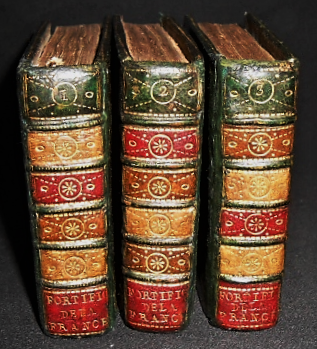
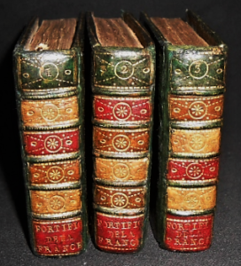
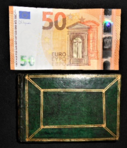
[Miniature Military Atlas]. [Pierre Lemau de La Jaisse]. [Fortifications de la France]. No place, no name and no date [Paris, between 1733 and 1736]. 110 engraved maps in 3 volumes in-32 Italian style (8,2 X 12,2 cm). 4 blank leaves, 37 engravings [1-37], 4 blank leaves; 4 blank leaves, 37 engravings [38-74], 4 blank leaves; 4 blank leaves, 36 engravings [75-110], 4 blank leaves. Half morocco alternating green, ochre, garnet and fawn parts, spine with five raised bands decorated with gilt roulettes and small gilt tools, title and volume number gilt, green paper boards imitating morocco decorated with double gilt fillets and small gilt floral irons at the intersections, gilt roulette on the cuts, inside richly decorated with gilt roulettes and fillet, edges gilt, pink tabis endpapers. ([Contemporary bound] by Padeloud [sic] son of the royal binder).
Untitled portable atlas, containing plans of the main places of war and frontier maritime towns of the kingdom. These 110 plans of fortified towns in medallion, are accompanied, also in medallion, by their coats of arms numbered from 1 to 110. They are organized by departments and general and particular governments of the provinces : Picardy, Artois, Flanders, Hainaut, Champagne, the 3 bishoprics, Alsace, Franche-Comté, Burgundy, Dauphiné, Provence, Languedoc, Roussillon, Navarre and Béarn, Guyenne, Aunis, Brittany and Normandy. Their longitudes and latitudes, their distances from each other and from Paris, their coats of arms and their descriptions, both ancient and modern, are indicated in a small text in French printed in italics. In 1736, the author will publish the Plans des principales places de Guerre et Villes maritimes frontières, an edition increased by 2 plans (“Sisteron” and “Hôtel Royal des Invalides”).
It is probably a revised edition of the Map of the French Monarchy that Pierre Lemau de La Jaisse published in 1733. Indeed, the plans and coats of arms have been kept identical, only the legends differ : they are not numbered, the longitudes precede the latitudes, the distances are rectified (for example Rocroy is 6 leagues from Mézières, and not 5, and Verdun is 17 leagues from Toul, and not 15), and the staffs are no longer mentioned (see the digitised copy on gallica: https://gallica.bnf.fr/ark:/12148/bpt6k5492298g/f54.item.zoom). Engraved on folio, the plans of each town were then cut out, re-embossed and mounted on double-page tabs. These portable atlases, in a “pocket” format, with an elegant binding, were probably intended, printed and mounted in this way, for a high-ranking military officer or rather a fortification engineer (which would justify the absence of any mention of the staffs), a sort of “vade mecum” which was very useful during inspection missions. The corps of royal engineers was in full expansion, and a royal school of engineering was opened in Mézières in 1748.
A pencil note on the front of the lower flyleaf of volume I states: “ALV [Purchased at a Sale?] – by Merlin – fer 1816 – N° 801. 3 volumes [?] Perhaps this is Antoine François Eugène Merlin (1778, Douai – 1854, Eaubonne), French general, hero of the wars of the Revolution and the Empire. Count, Knight of the Empire, Grand Officer of the Legion of Honour, Knight of Saint-Louis, Peer of France, his name is engraved under the Arc de Triomphe de l’Étoile, 29e column. He had followed his father, Merlin de Douai, into exile, proscribed by the order of 24 July 1815 for having served Napoleon during the Hundred Days. He boarded the American ship the Alice, in Antwerp, to go to America, and they were shipwrecked at the mouth of the Escaut, near Flessingue on 24 February 1816.
The famous bookbinder of Louis XV and the Pompadour, Antoine-Michel Padeloup, had a bookbinder son, Jean, to whom he had passed on his title of ordinary bookbinder to the King of Portugal. Antoine-Michel had received the patent of ordinary bookbinder of the King on August 23, 1733, which inclines us to date our binding from the few years that followed. The binding plates of the 18th centurye in imitation morocco paper are particularly rare.
Very discreet restorations.
A rare and particularly fine miniature atlas in very good condition.
Sold


