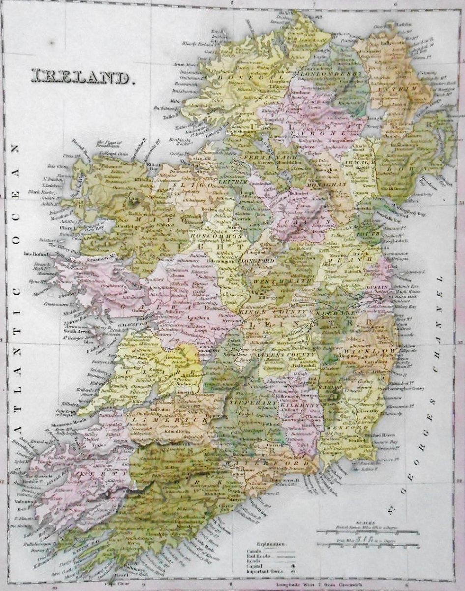
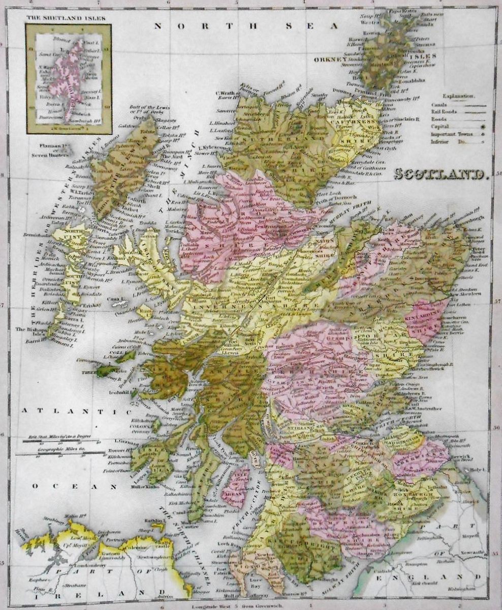
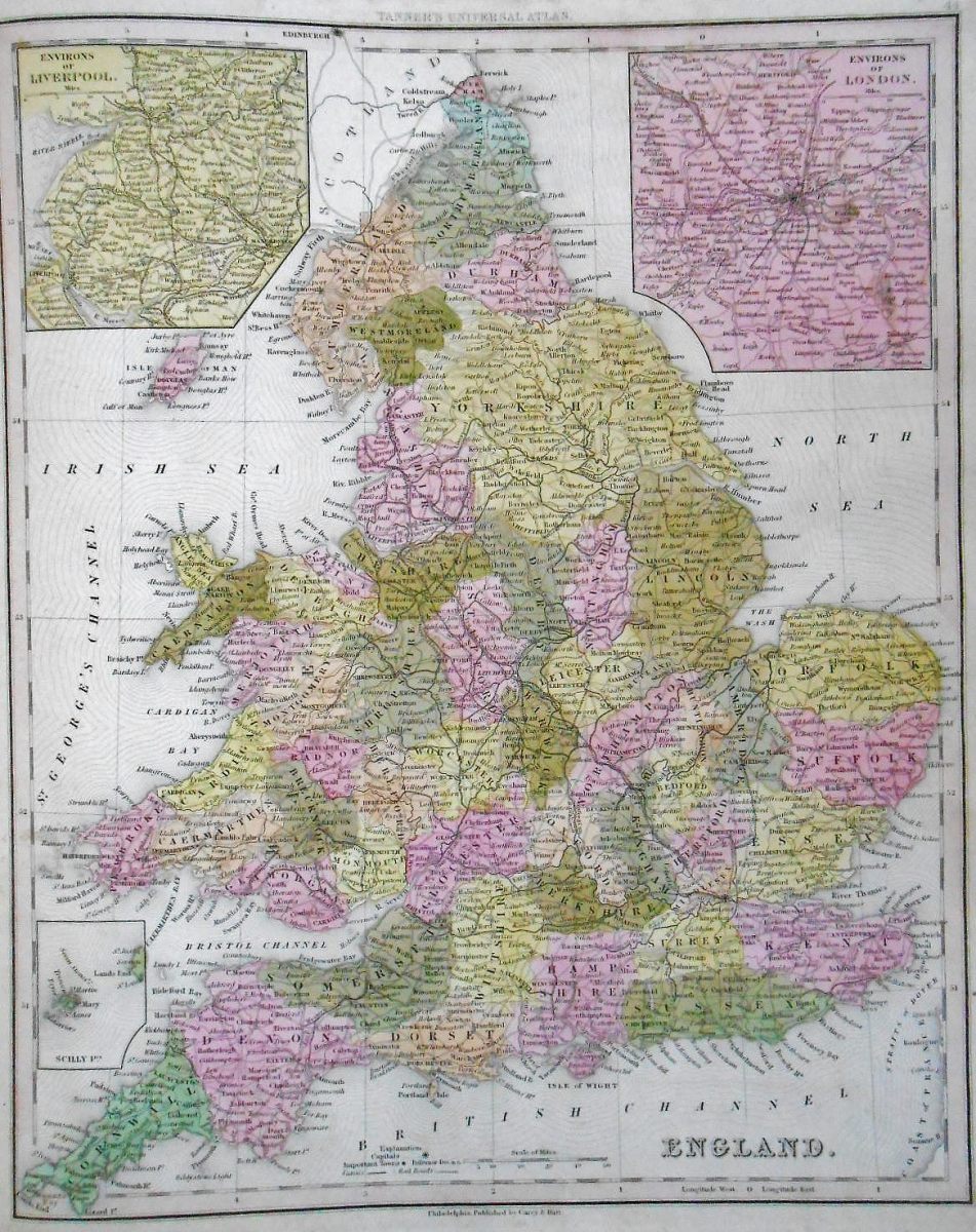
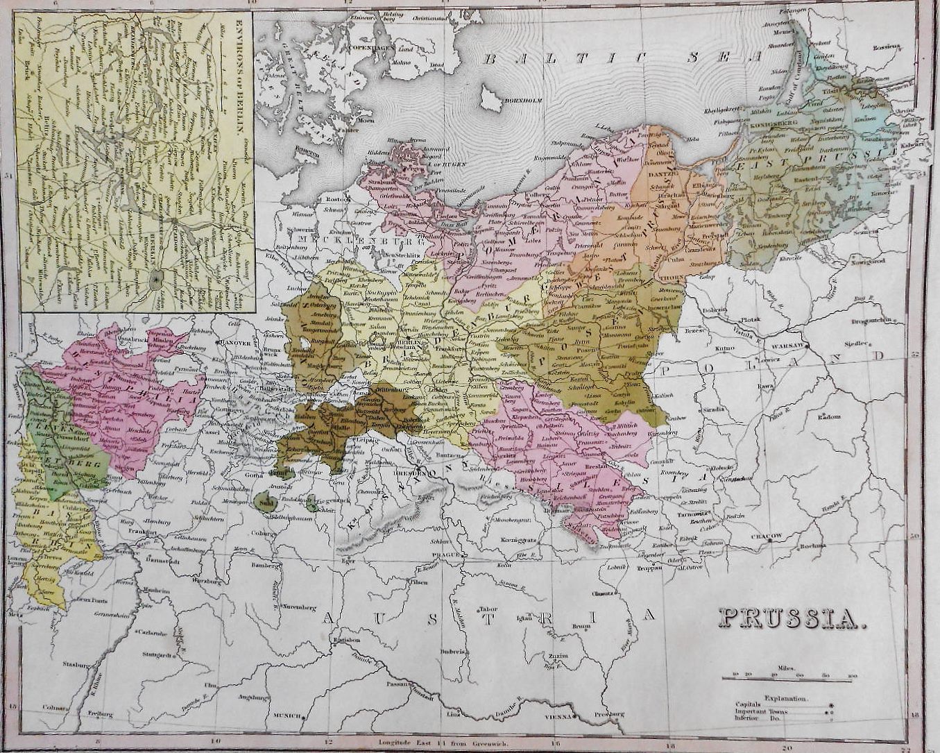
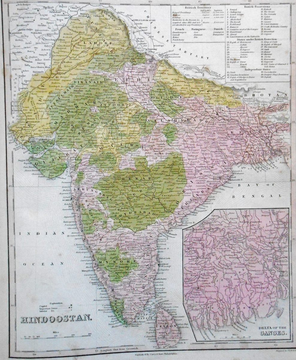
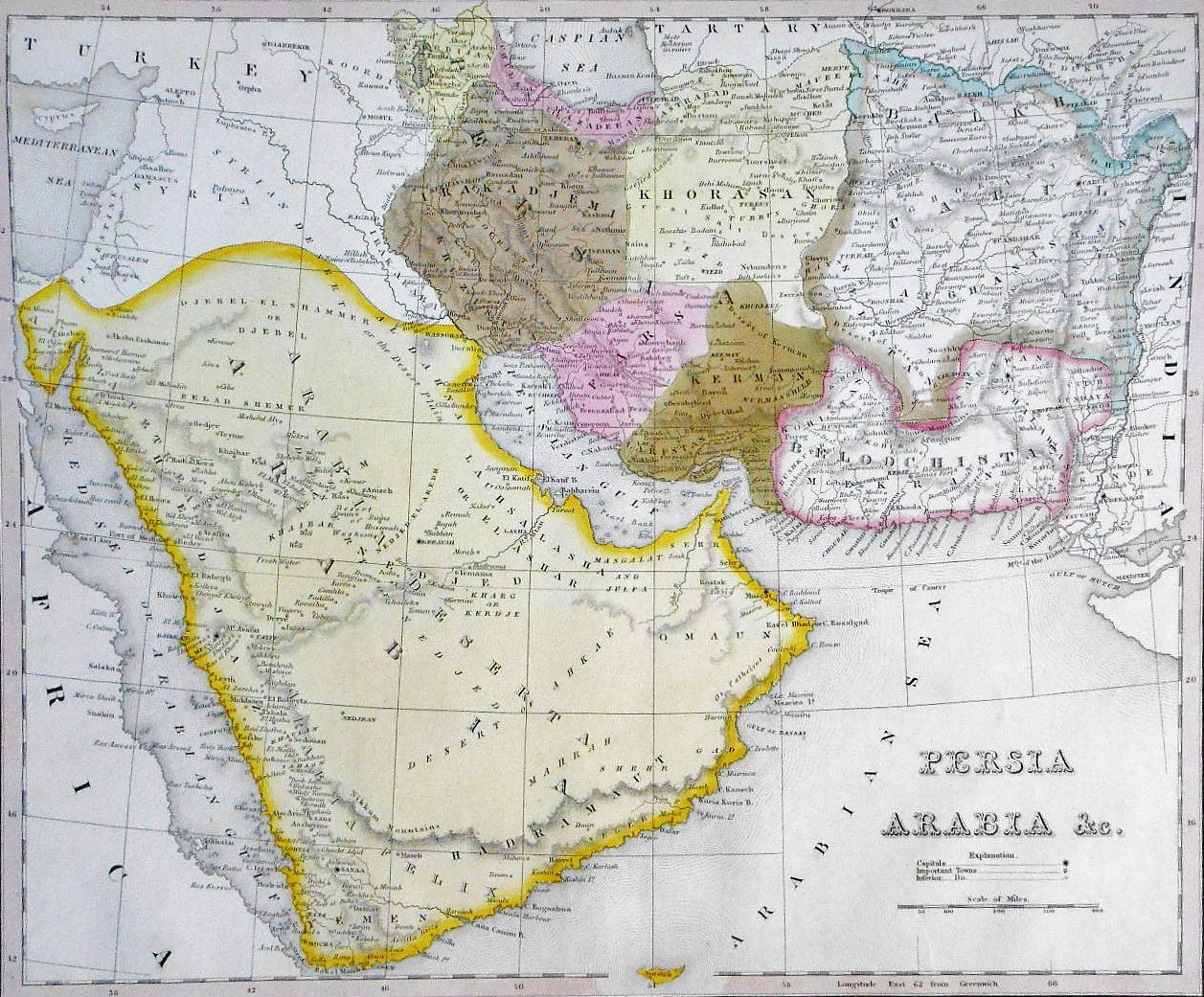
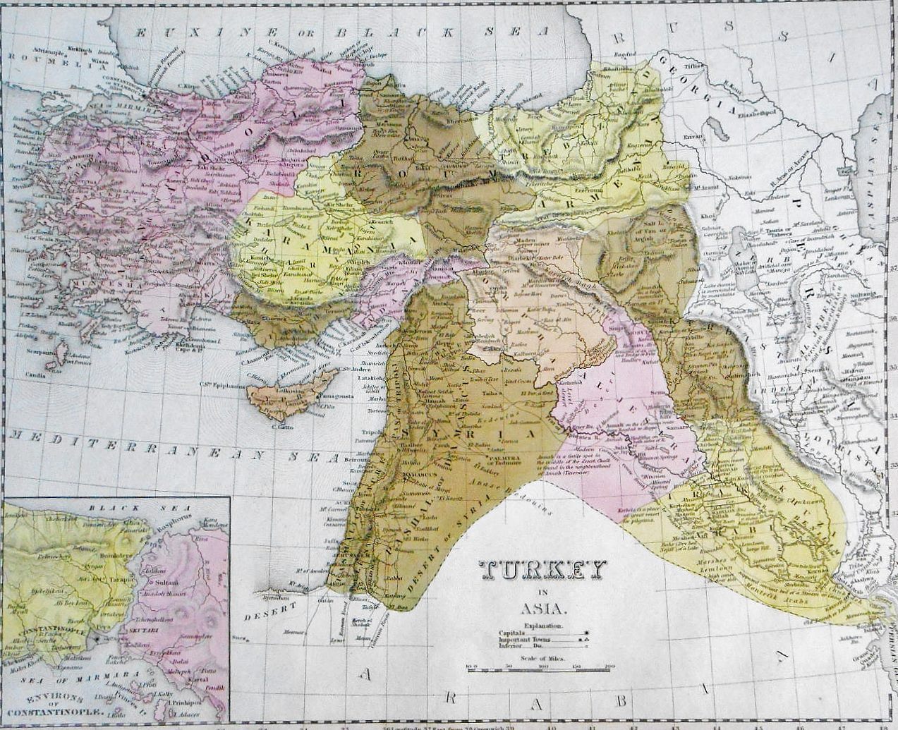
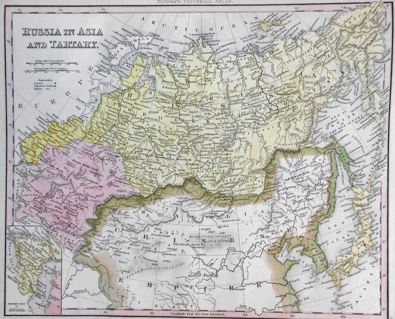
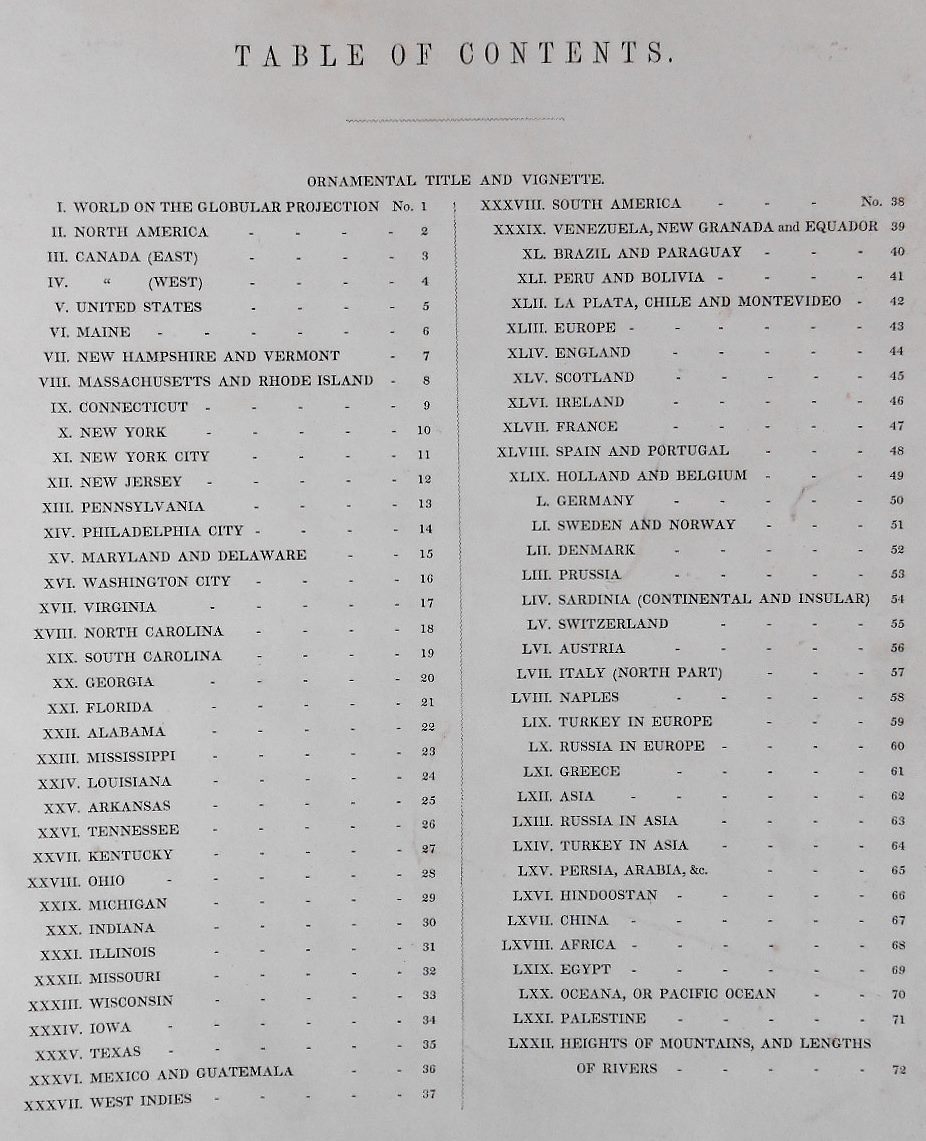
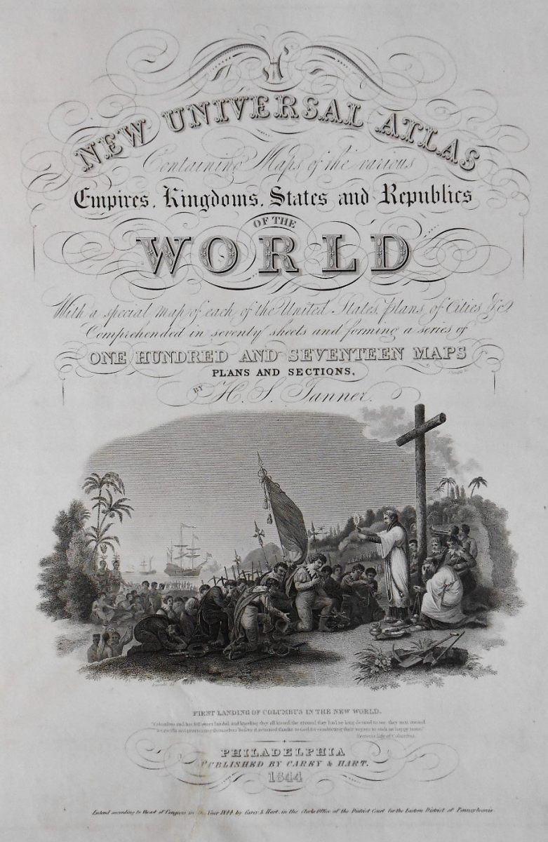
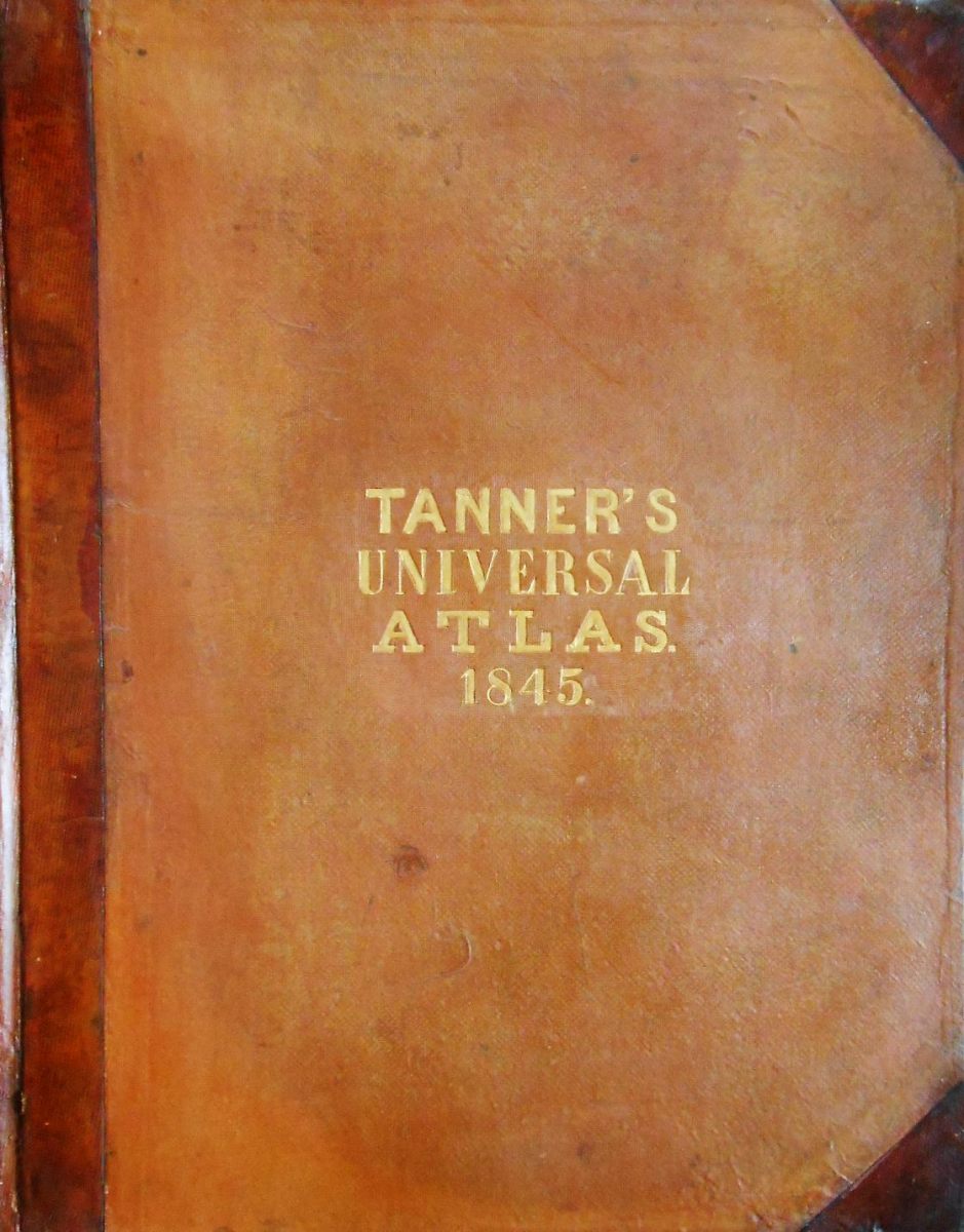
Henry Schenck Tanner. A New Universal Atlas, containing Maps of the various Empires, Kingdoms, States and Republics of the World. With a special map of each of the United States, plans of cities, &c. Comprehended in seventy sheets and forming a series of one hundred and seventeen maps, plans and sections. Philadelphia, Carey & Hart, 1844. In-folio. 2 blank leaves, frontispiece, engraved title, [4] pp. (notice and table), 72 plates [whose frontispiece] engraved and finely watercoloured (according to the table of plates), 2 blank leaves. Editor binding in fawn-coloured half-sheepskin morocconed with corners, long back decorated with gilt fillets, cover in cloth sienna color with gilt title “Tanner’s universal atlas” dated 1845 in the centre of the front cover.
Rare American atlas, complete with its finely engraved and watercoloured plates. Precious and elegant edition carefully and fully reviewed, “greatly improved beyond any that has preceded it . A great amount of interesting matter has been added to nearly every part of it, particulary in the geography of our own country, thus rendering it, by the accuracy of the information contained in the Universal Atlas, the distinctness of the Engraving and the splendour of the Colouring, the most elegant and complete work of the kind that has yet appeared in the United States, and greatly superior in its representations of American Geography, to any similar production published elsewhere “, as the editors’ notice indicates, dated Philadelphia, 25 septembre 1844. Tanner had published his New Universal Atlas in 1836, 1839 and 1842, when he sold theplates to Carey and Hart in 1843 (date of the World map of our atlas). This is the first edition under their name of this atlas, which will be followed by a second 1845, in a different frame. The two partners will sell to S. For. Mitchell in 1846, after Carey’s death on 16 June of this year. The publication will continue under various publishers until 1859 by Cushing and Bailey, one year after Tanner’s death, putting an end to the “Golden Age of American Map Publishing “.


“Tanner was a leading figure in the development of commercial mapping in America and brought the atlas as an early-maturing mapping form during the’“Golden Age” American copper engraving. He combines the skills of a geographer with those of a publisher and engraver to create authoritative maps during a period of unprecedented growth in topographic knowledge of North America.. He represented the emergence in the world of American publishers of specialized maps, and he placed map compilation and atlas design on a new scientific basis, introducing uniform map scales into atlases and documentation of sources used. He decisively reinforced Melish’s brief momentum for the rise of American map publishing and set standards that publishers later took for granted.” (Michael P. Conzen).

Among the plates, all engraved, 25 are anonymous, the others are by J. & W. W. Warr (18), J. Knight (8 and the title after Humphrys), Humphrys (frontispiece, n° 72), E. B. Dawson (7), W. Brose (7), F. Dankworth (3), E. Gillingham, G. W. Boyton and W. Haviland.
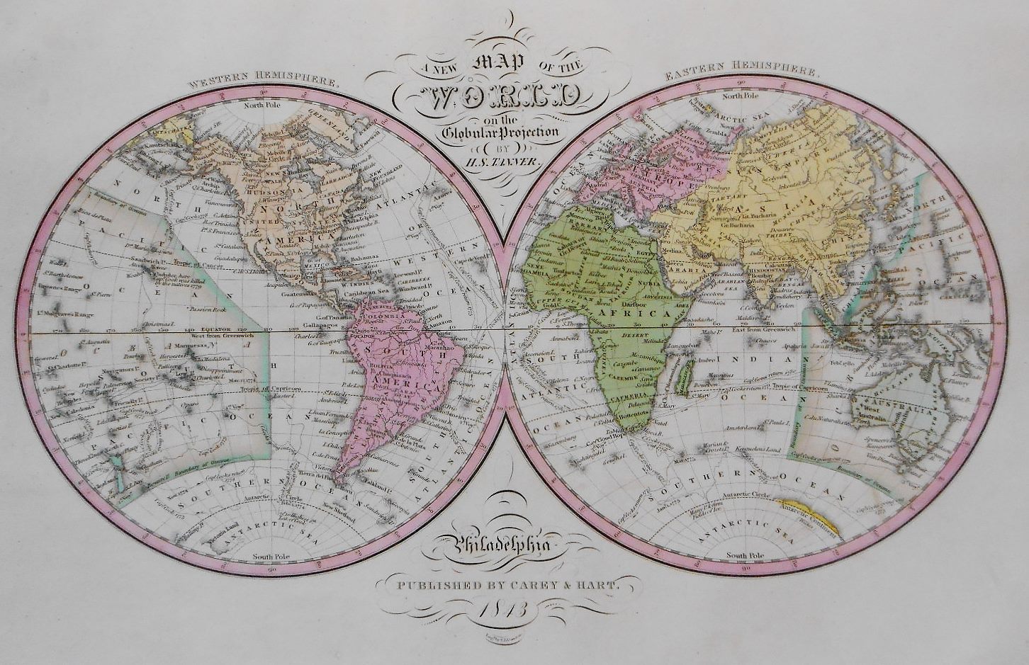
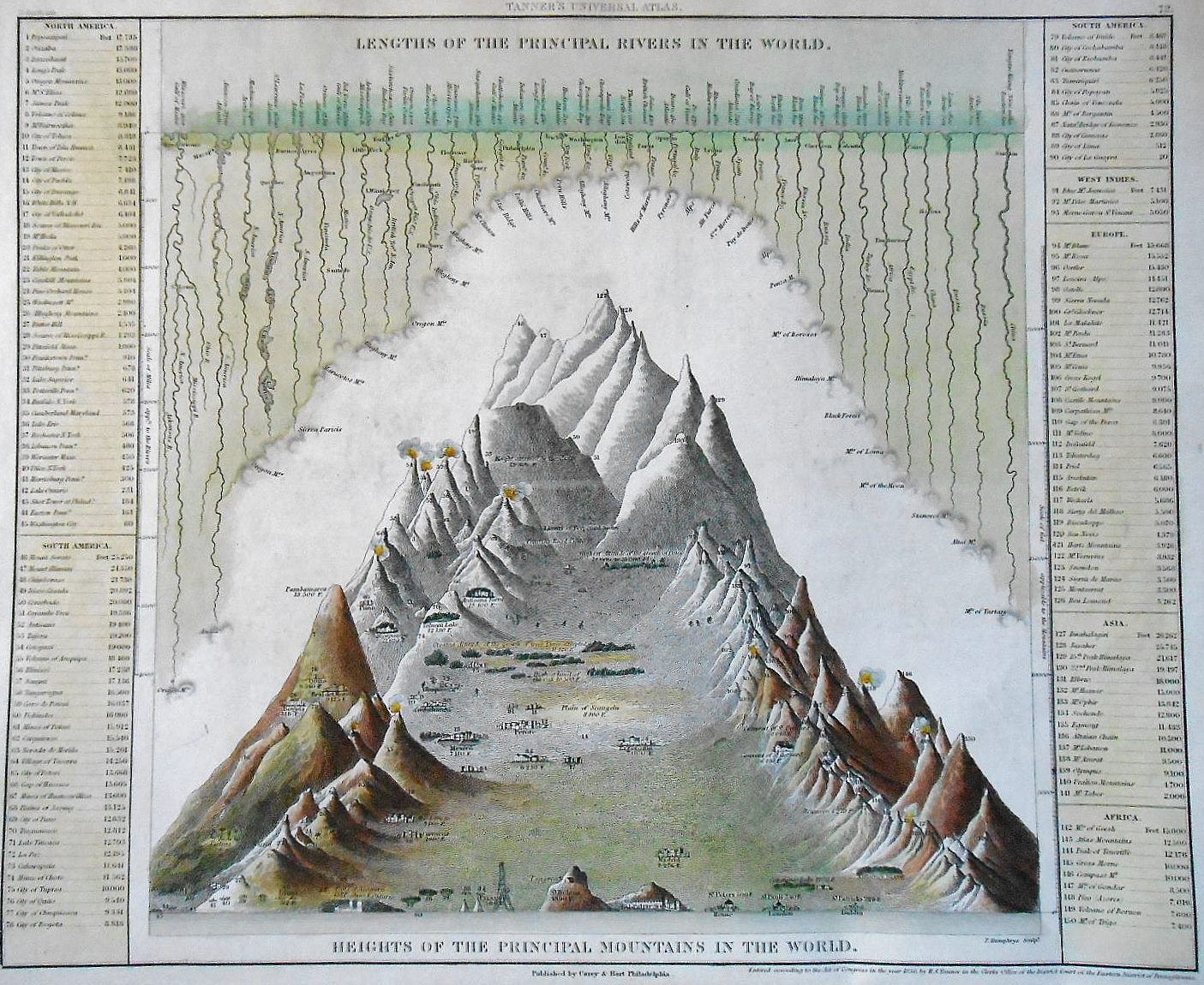
The frontispiece, engraved by Humphrys, represents the length of major rivers and the height of the world’s major moutaintops.

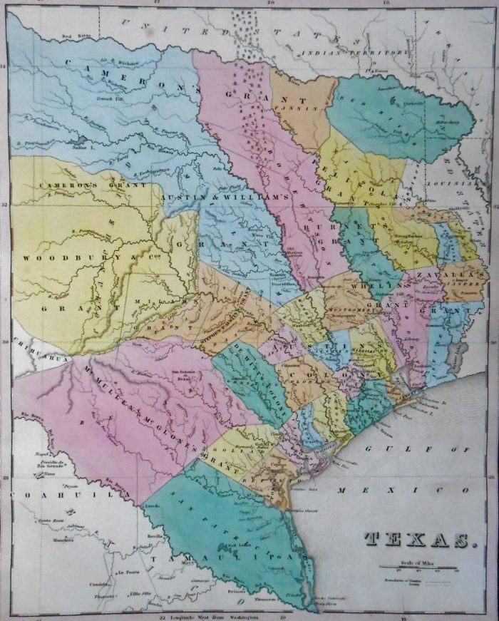
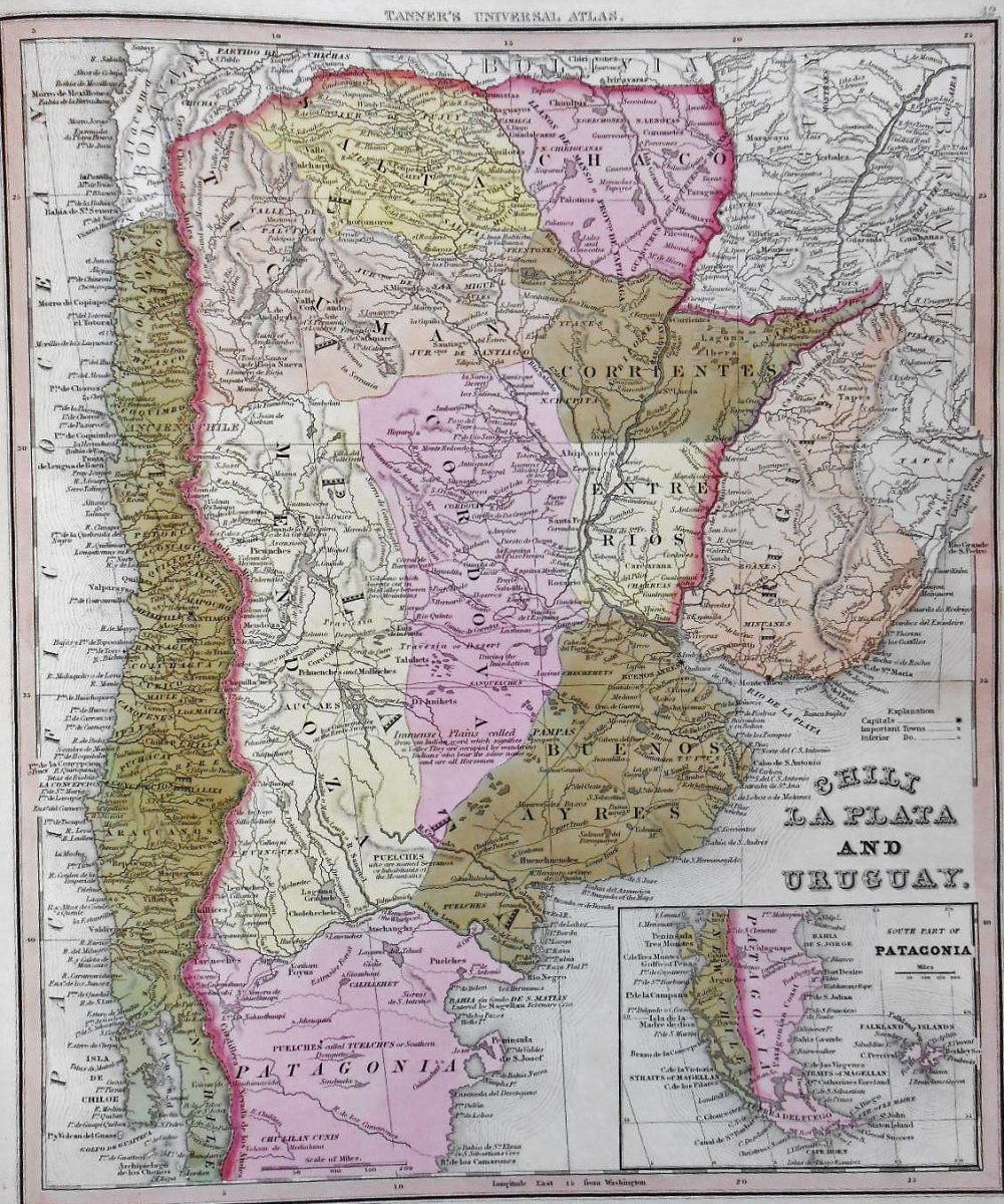
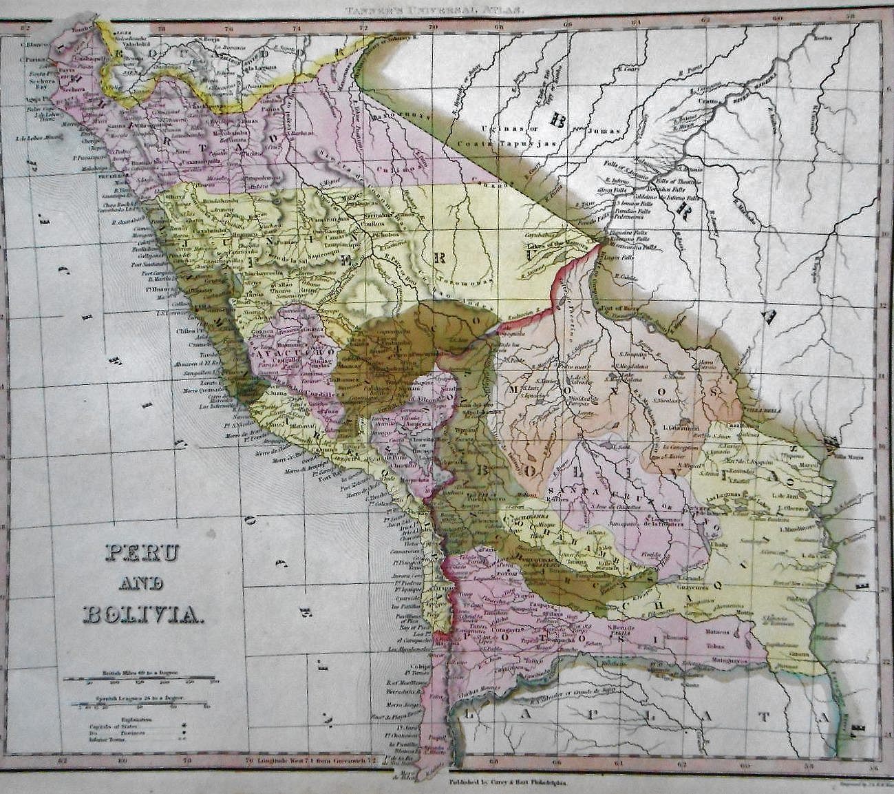
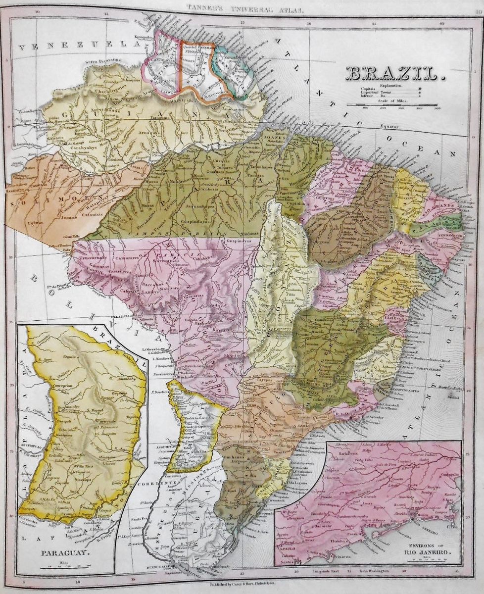
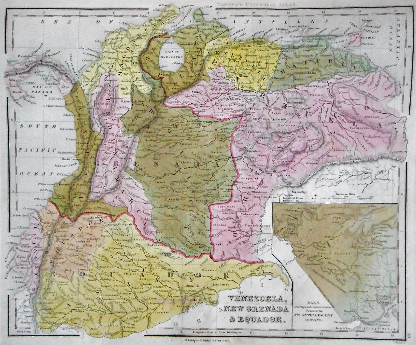
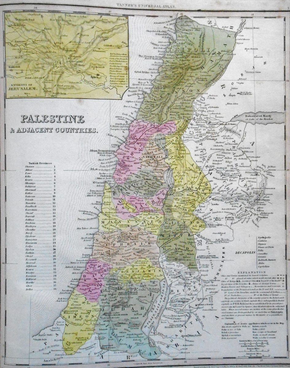
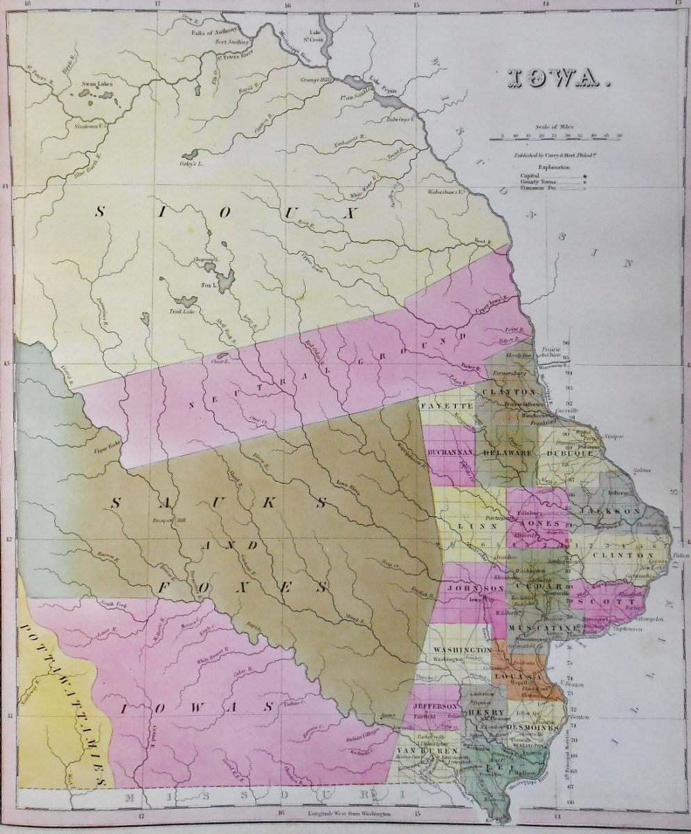
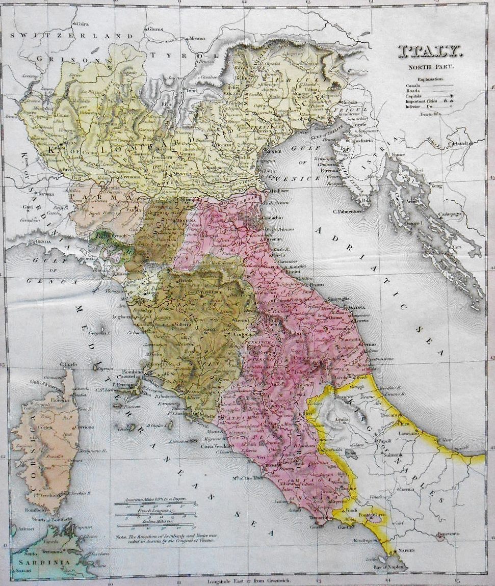
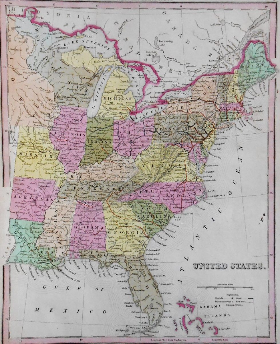
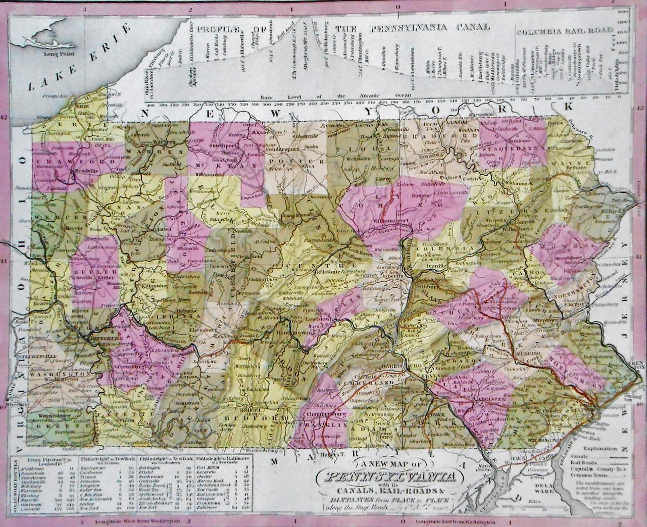
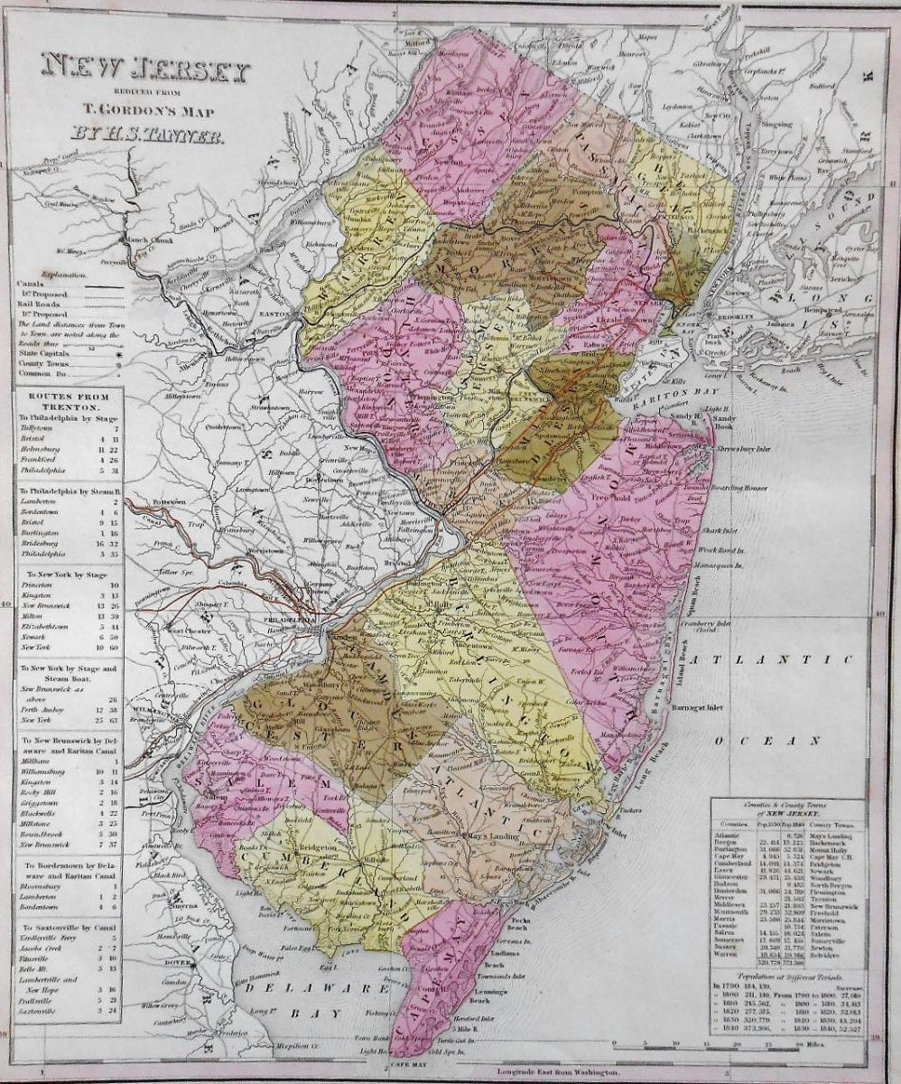
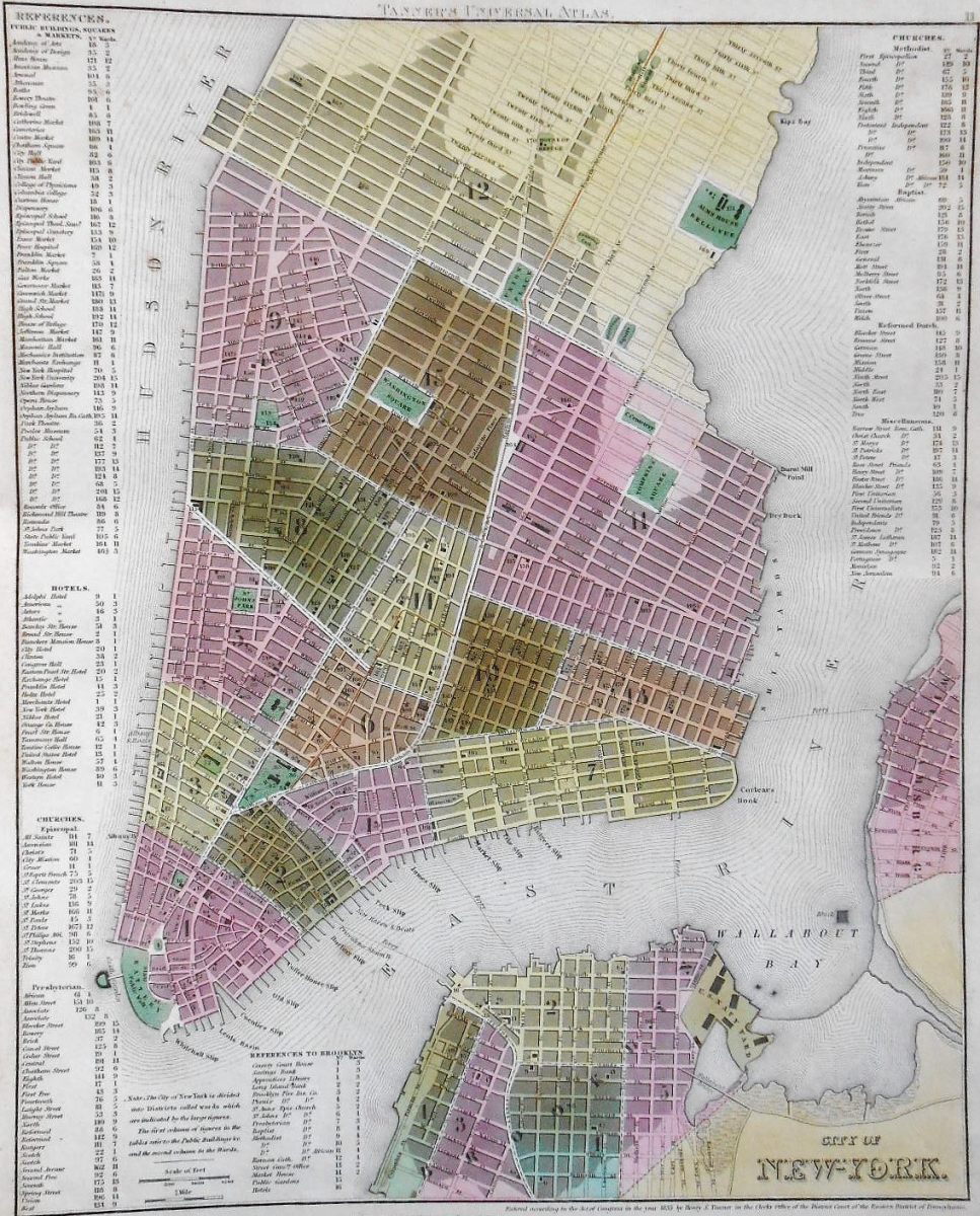
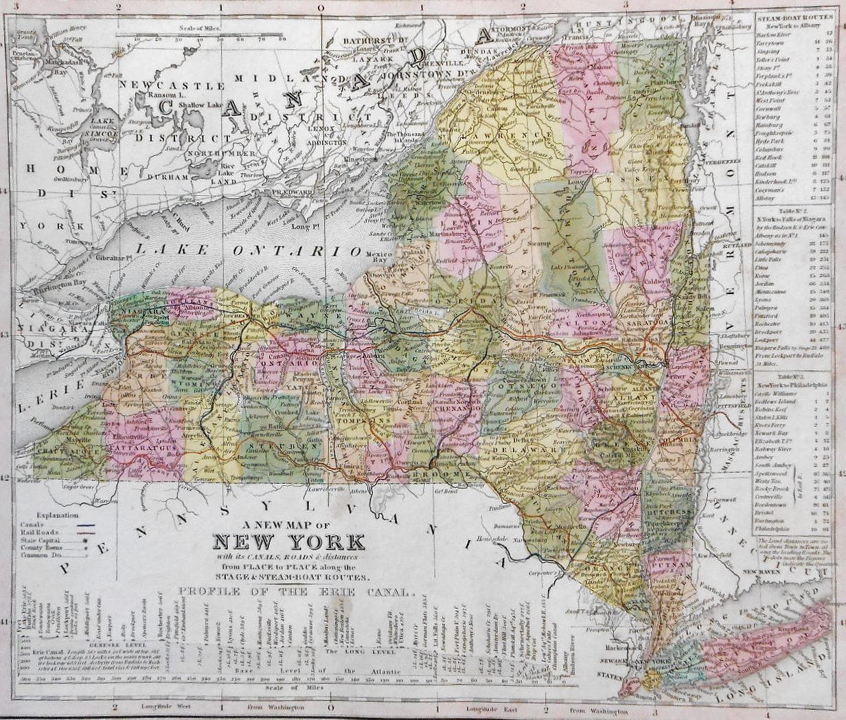
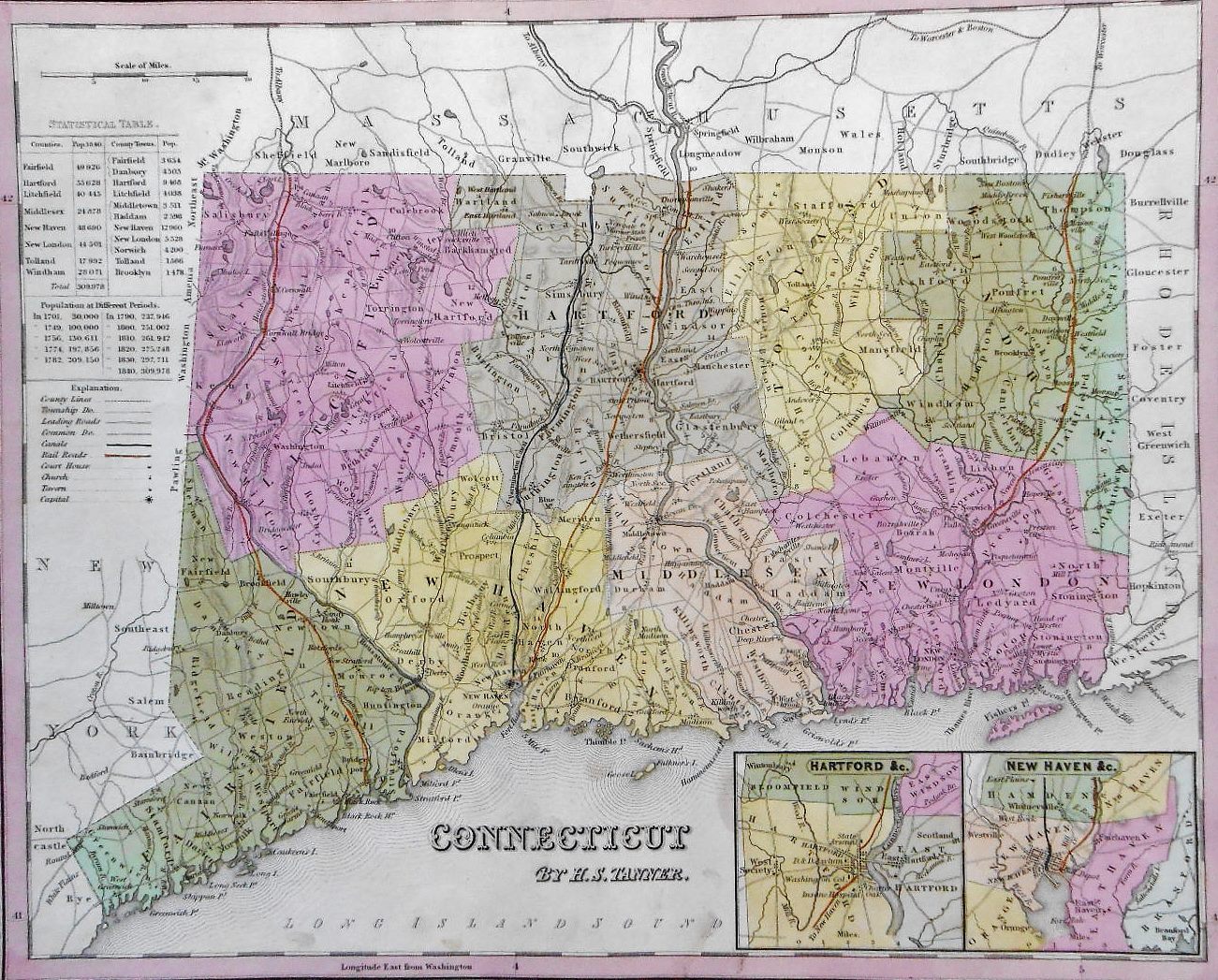
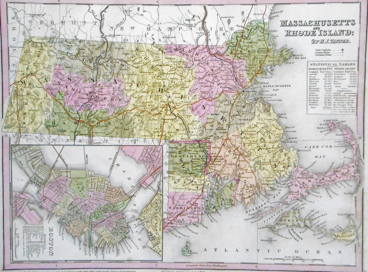
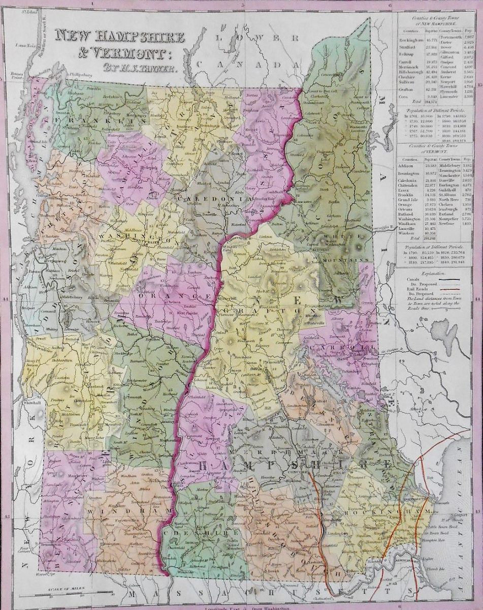
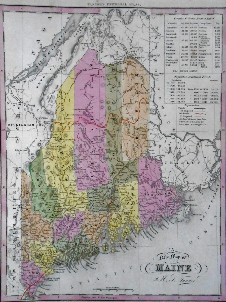
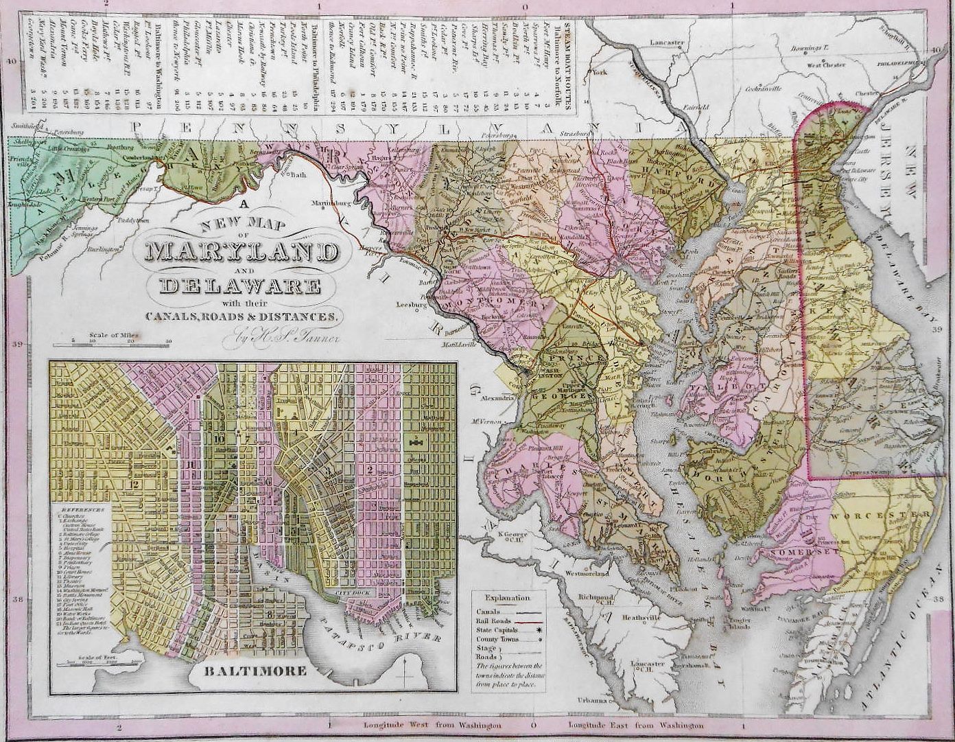
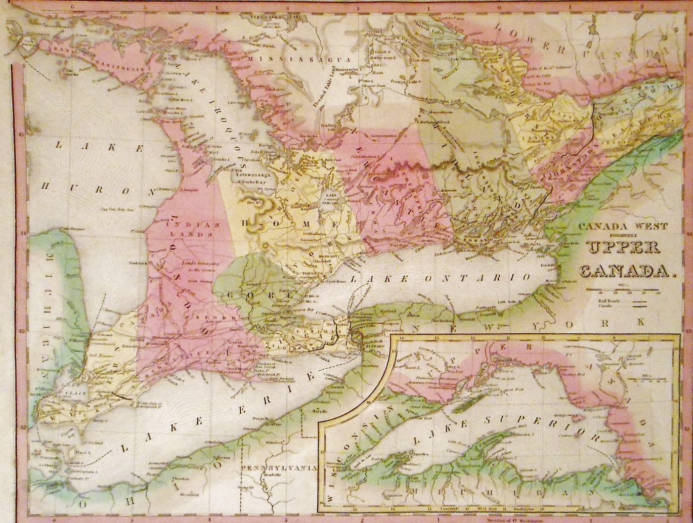
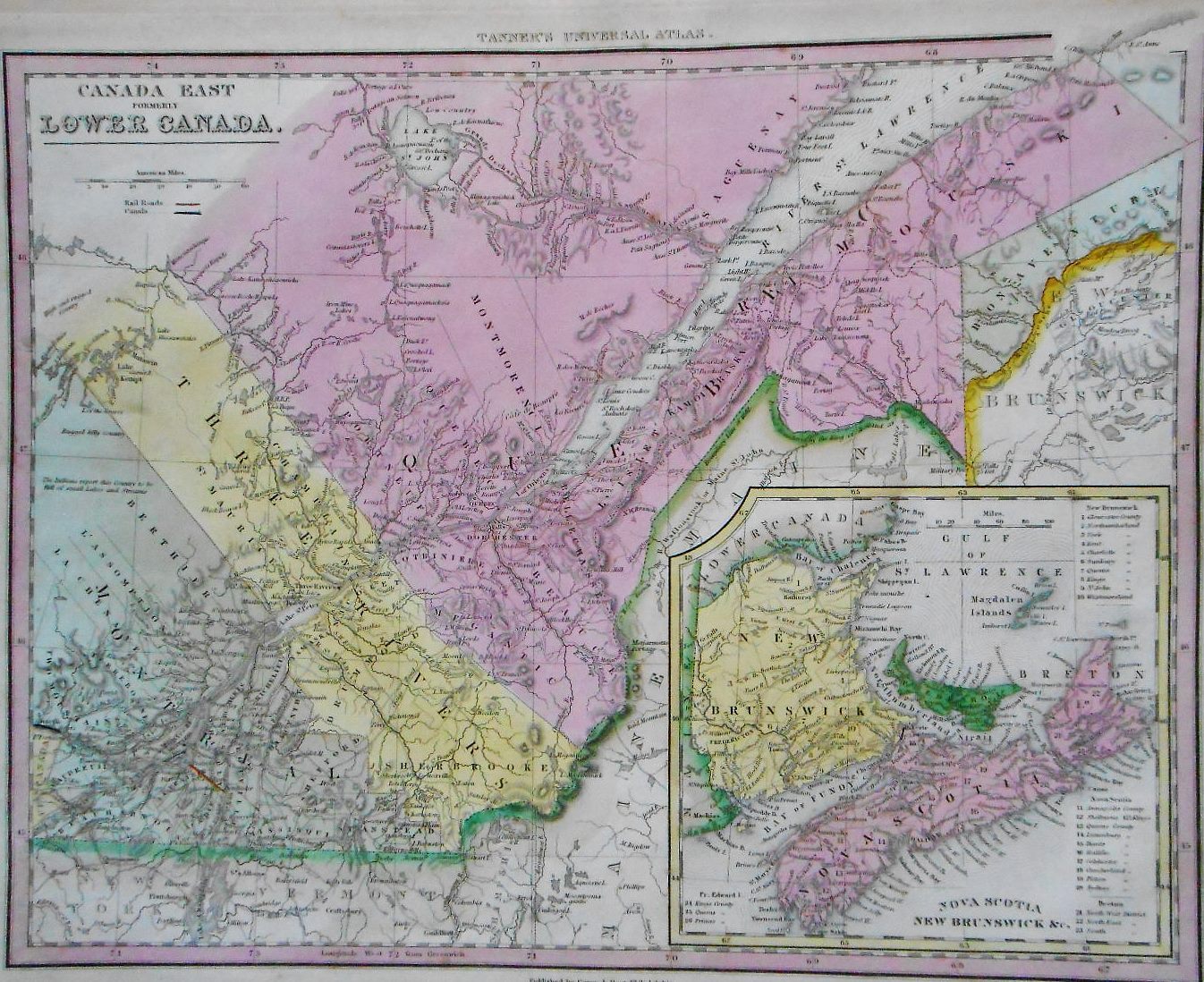
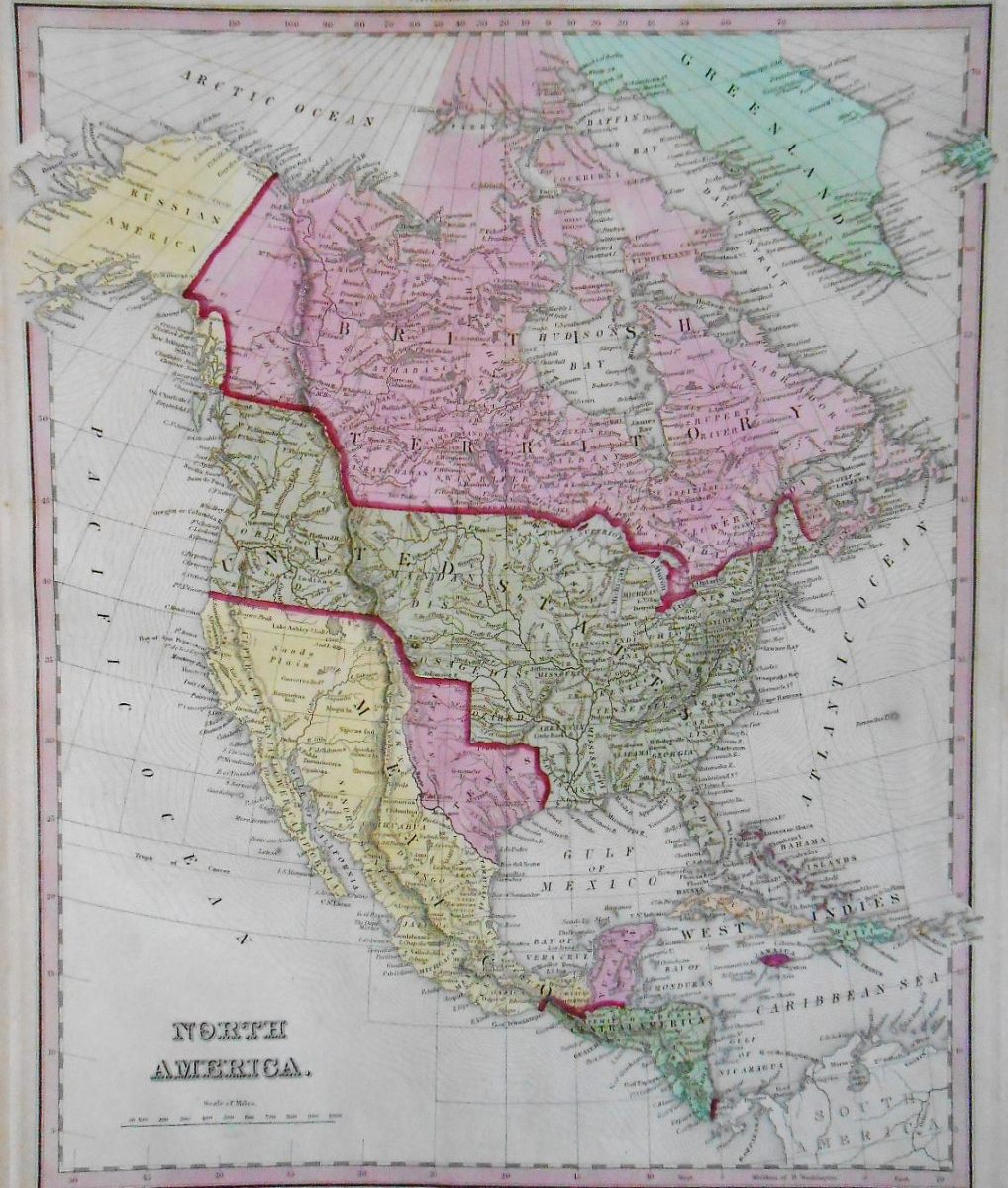
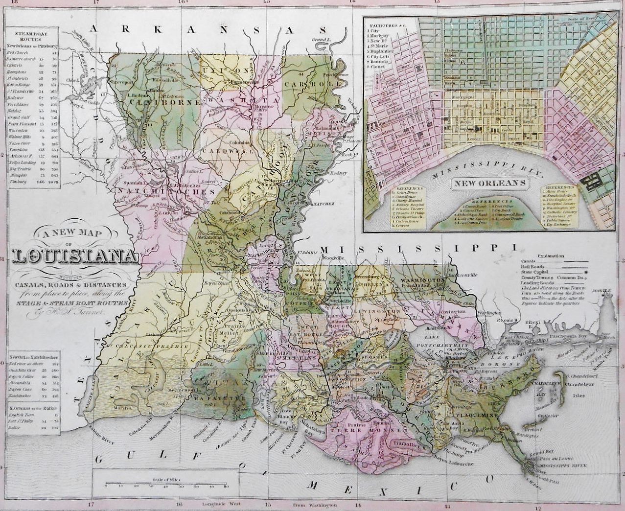
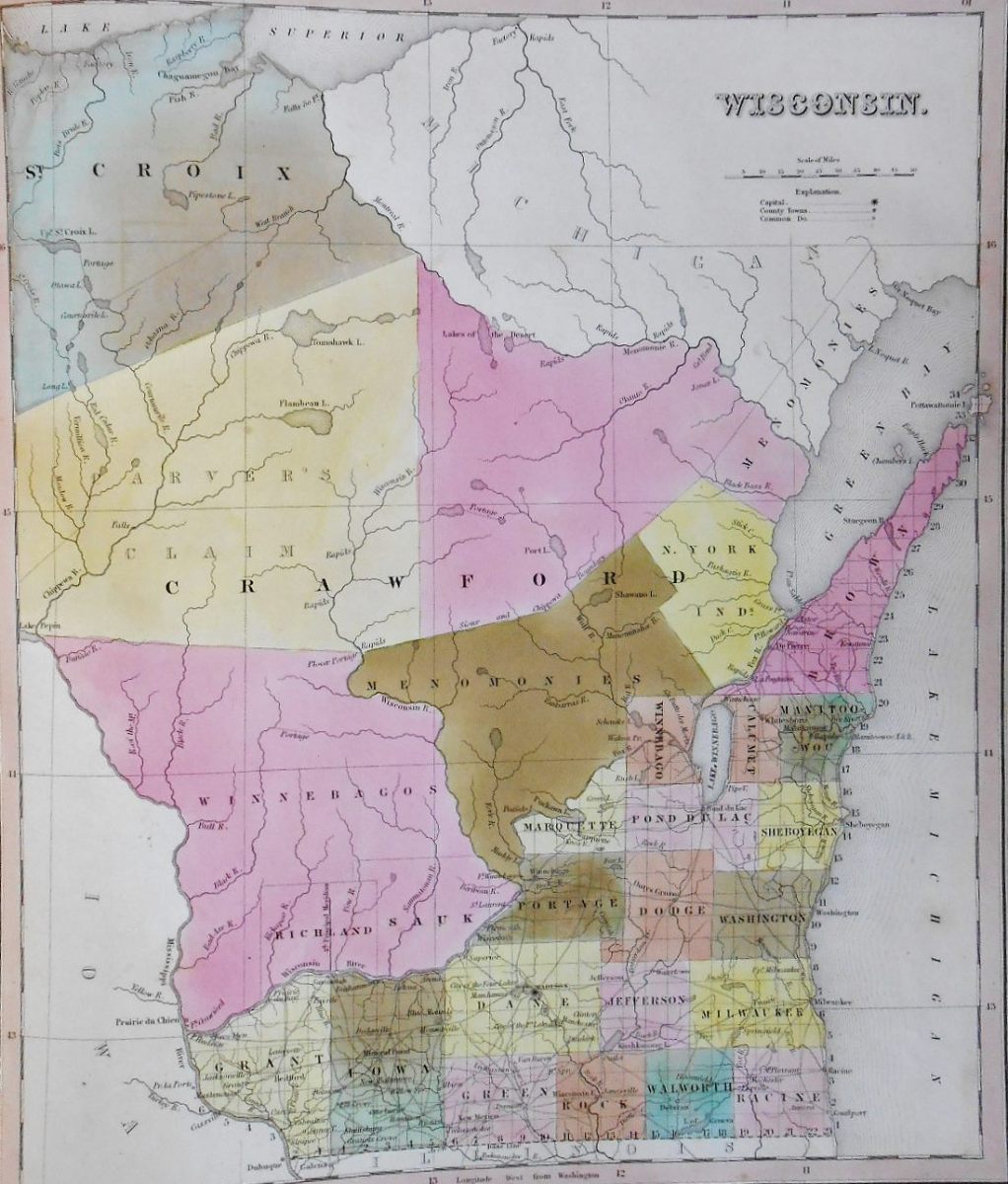
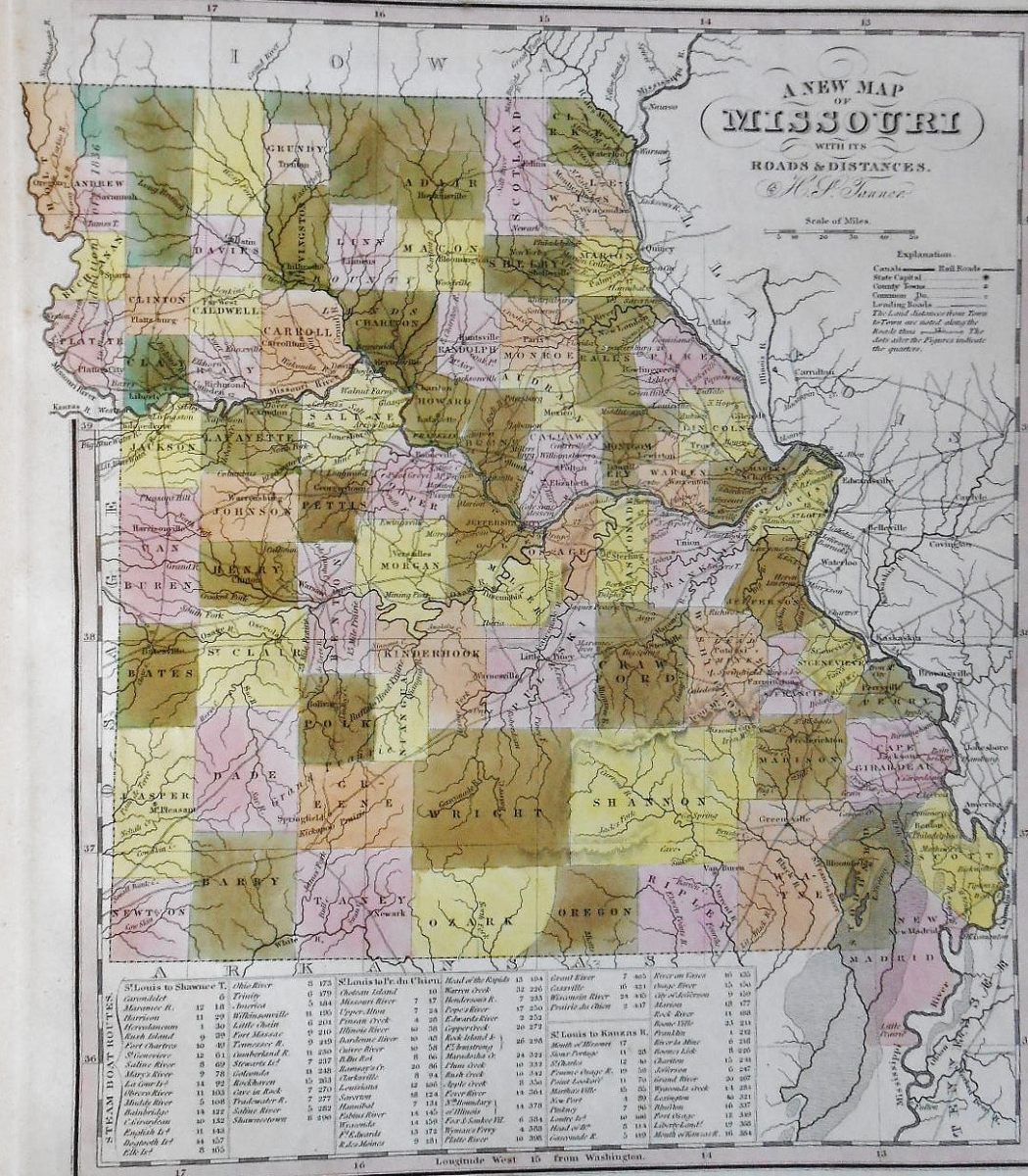
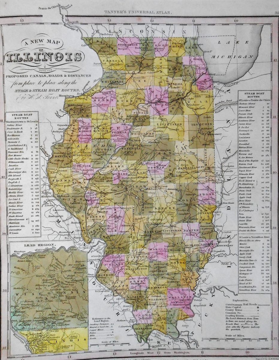
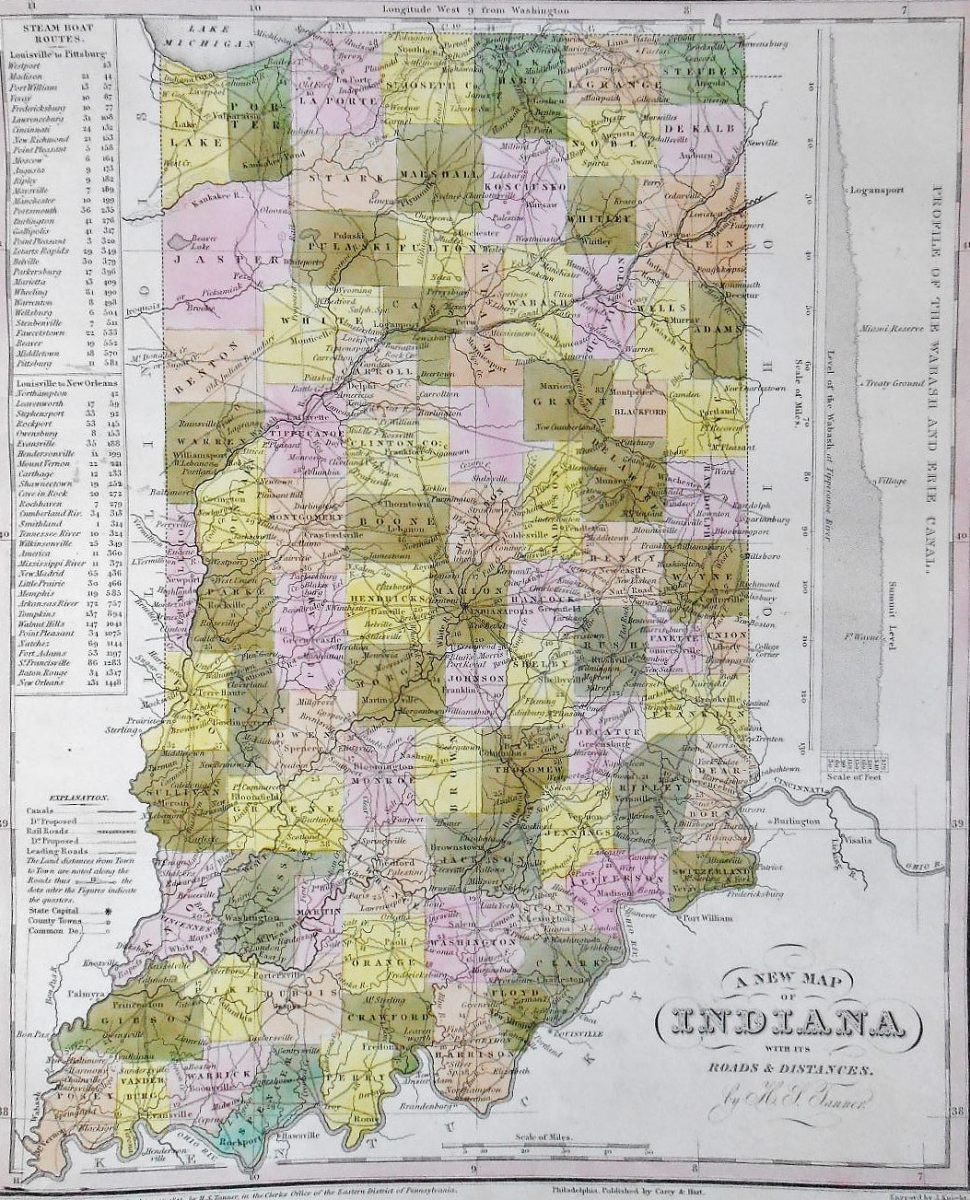
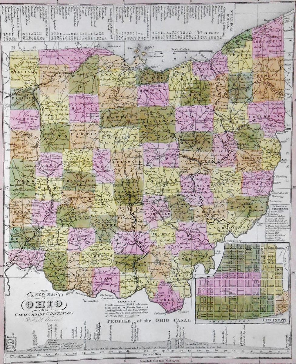
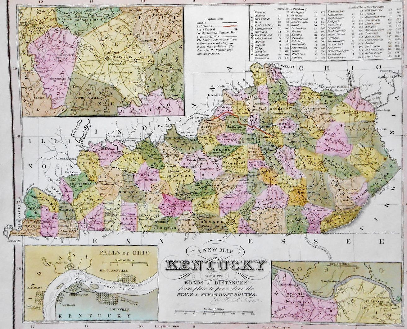
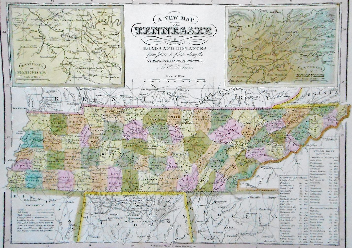
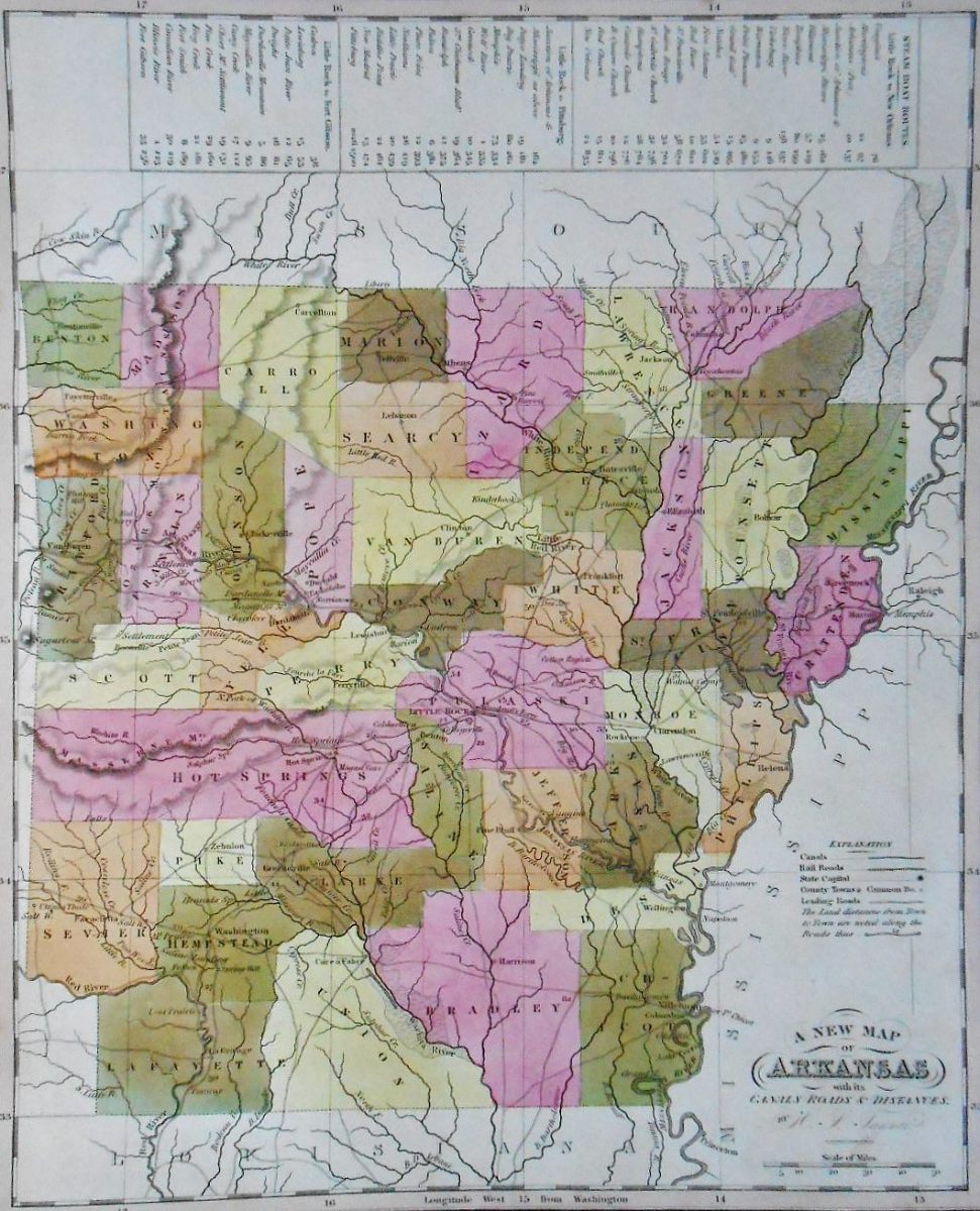
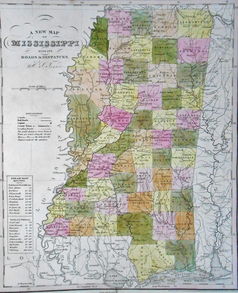
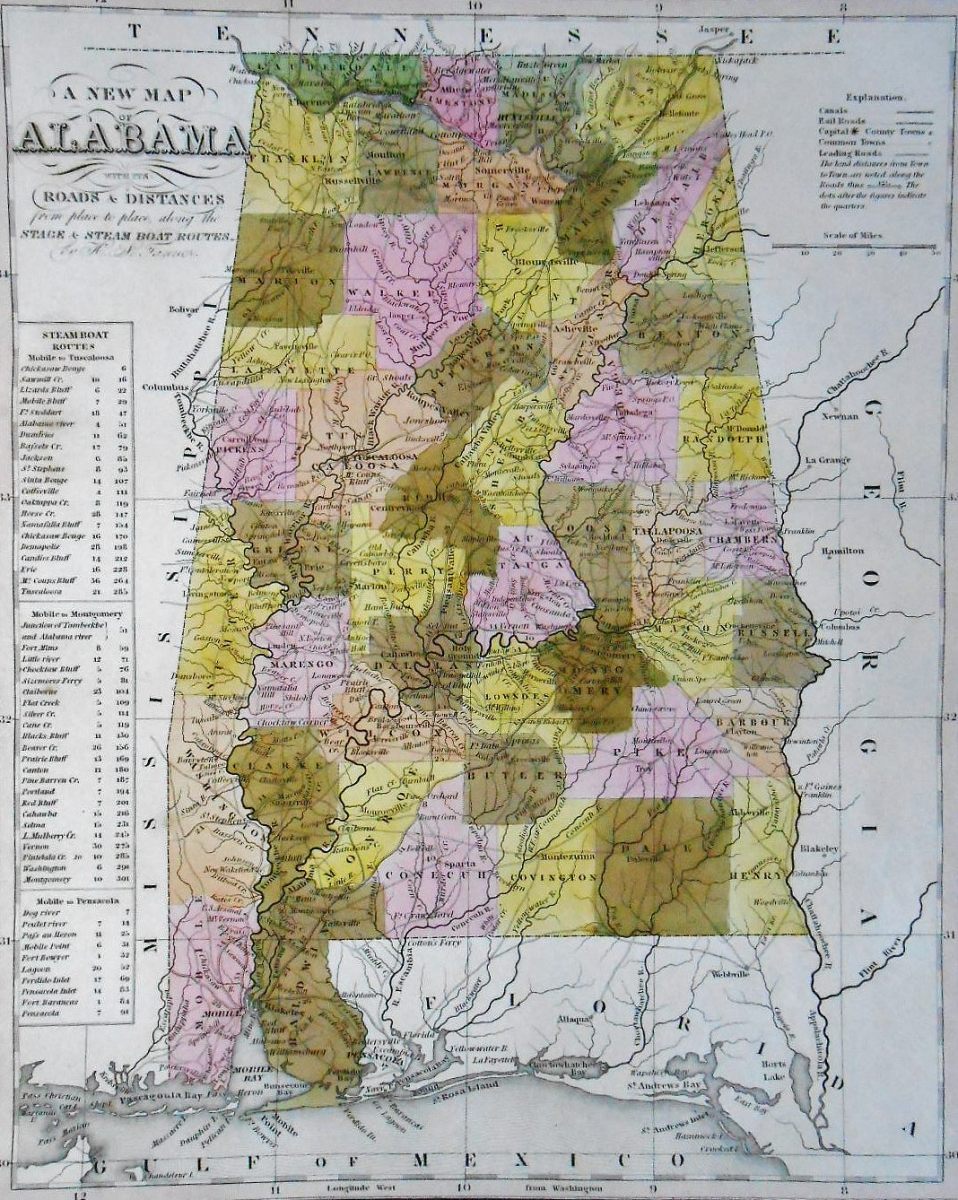
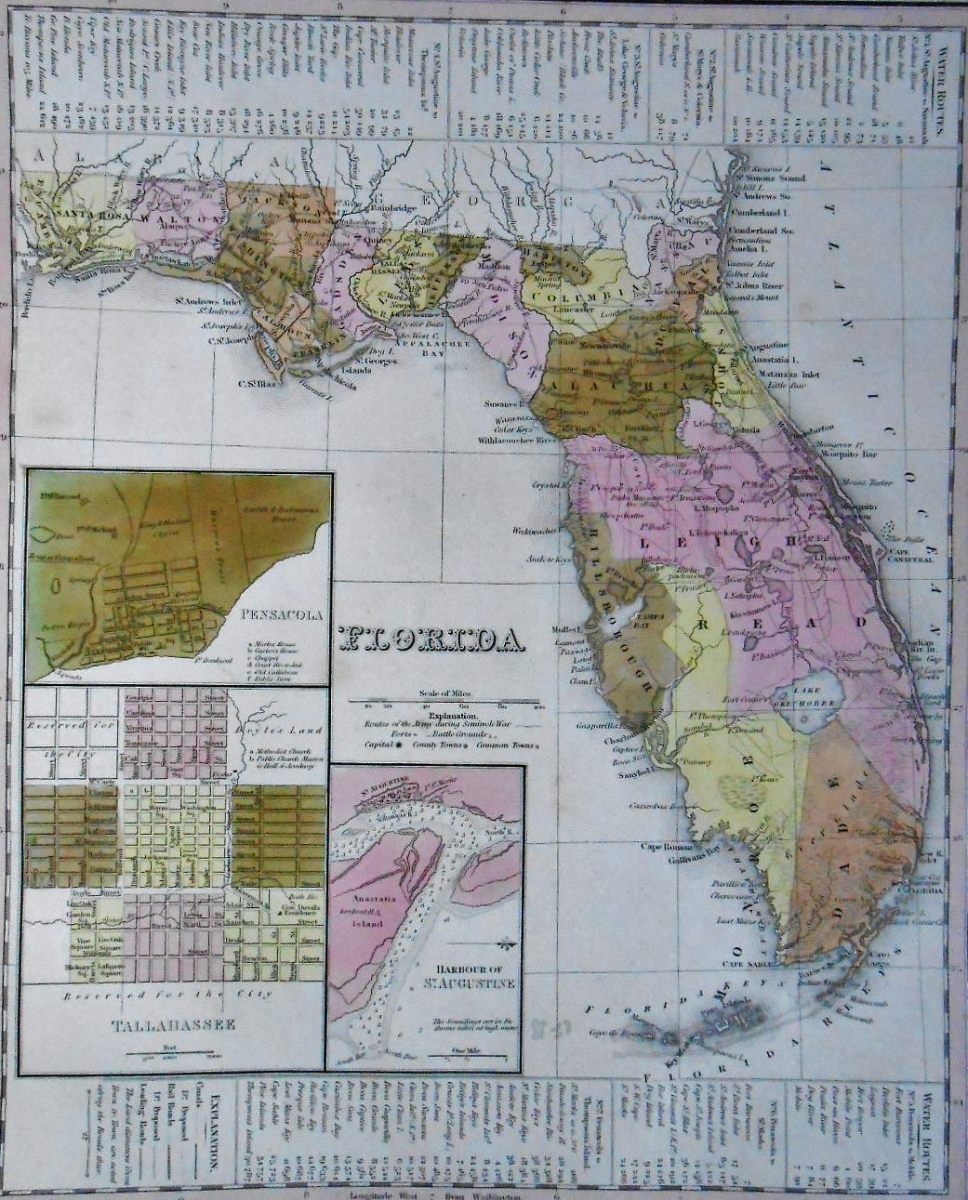
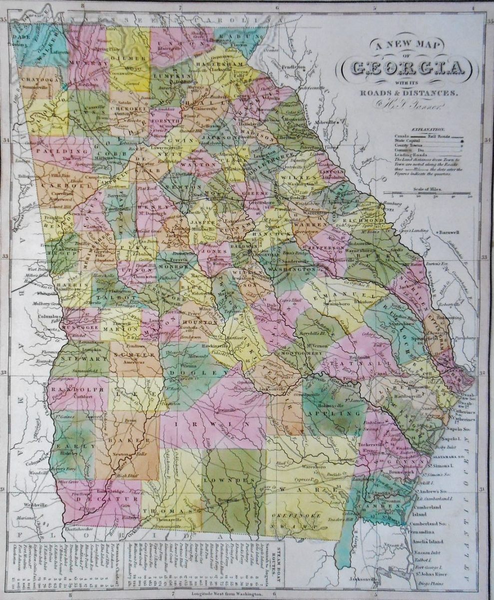
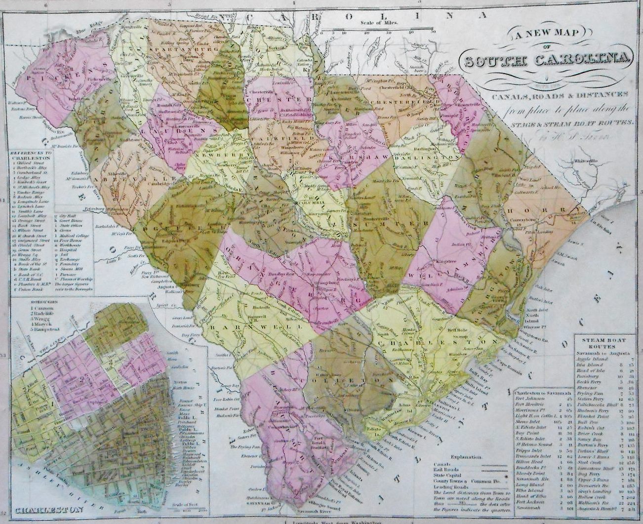
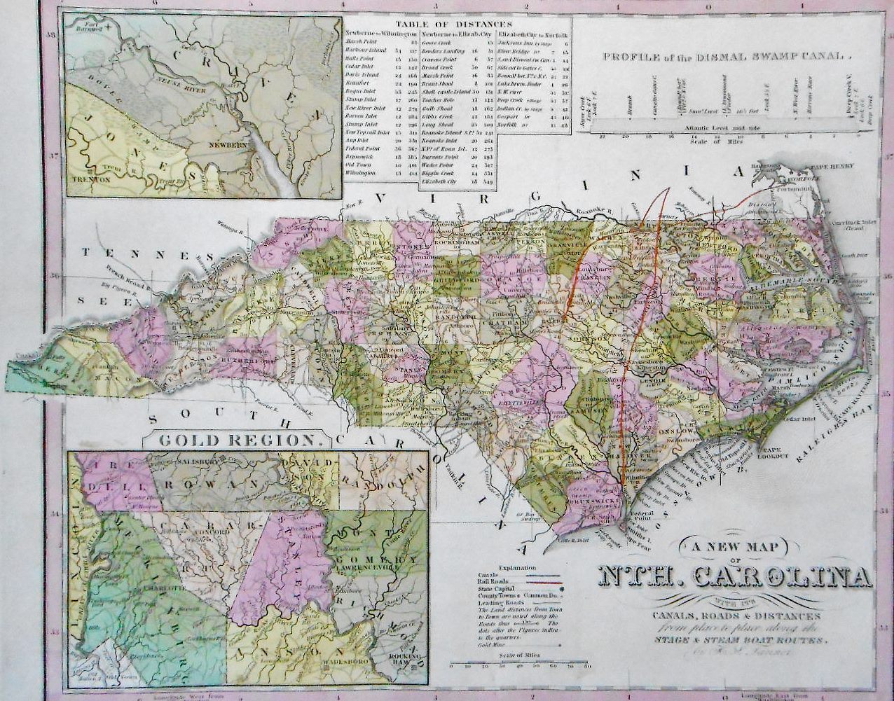
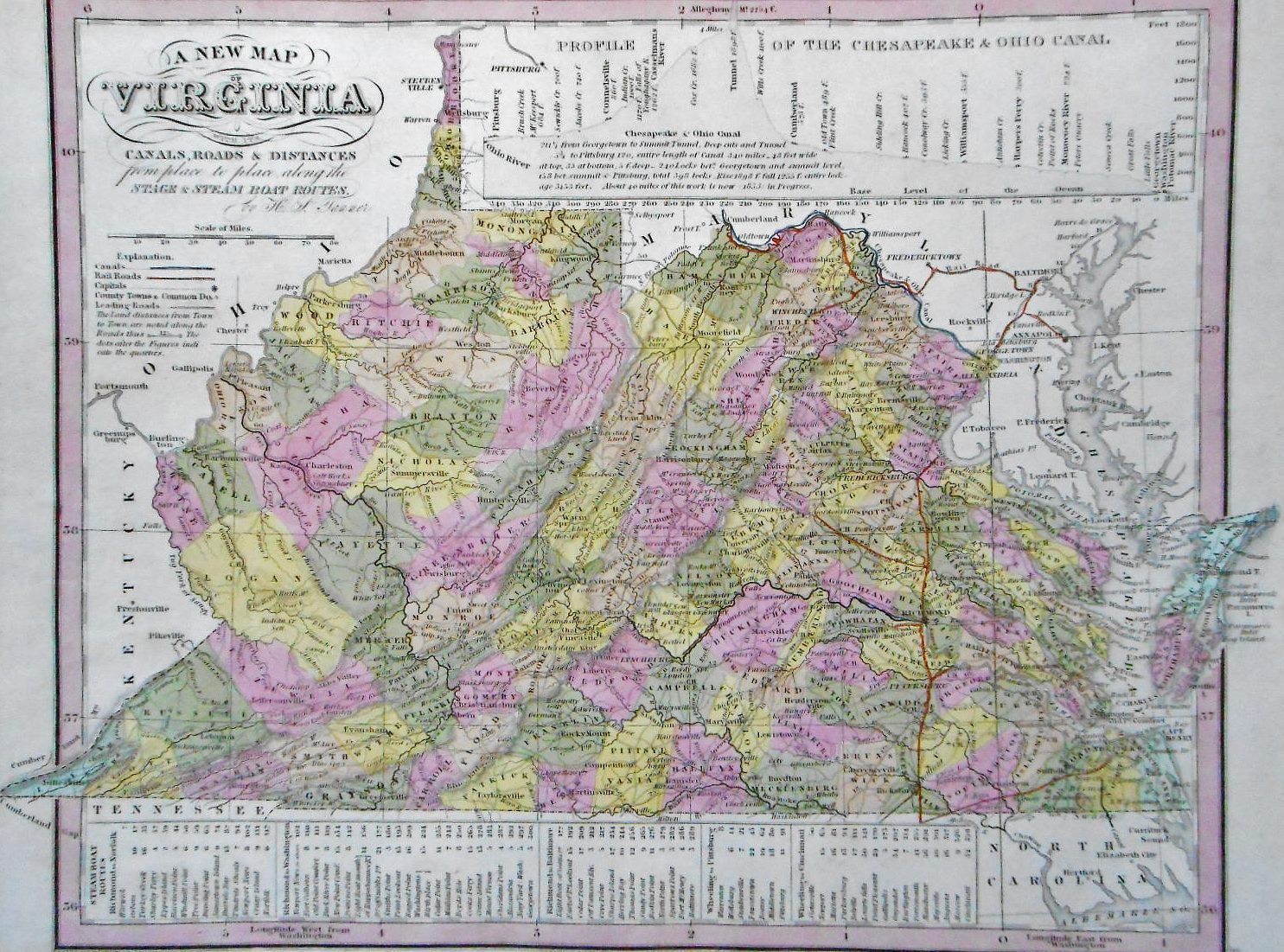
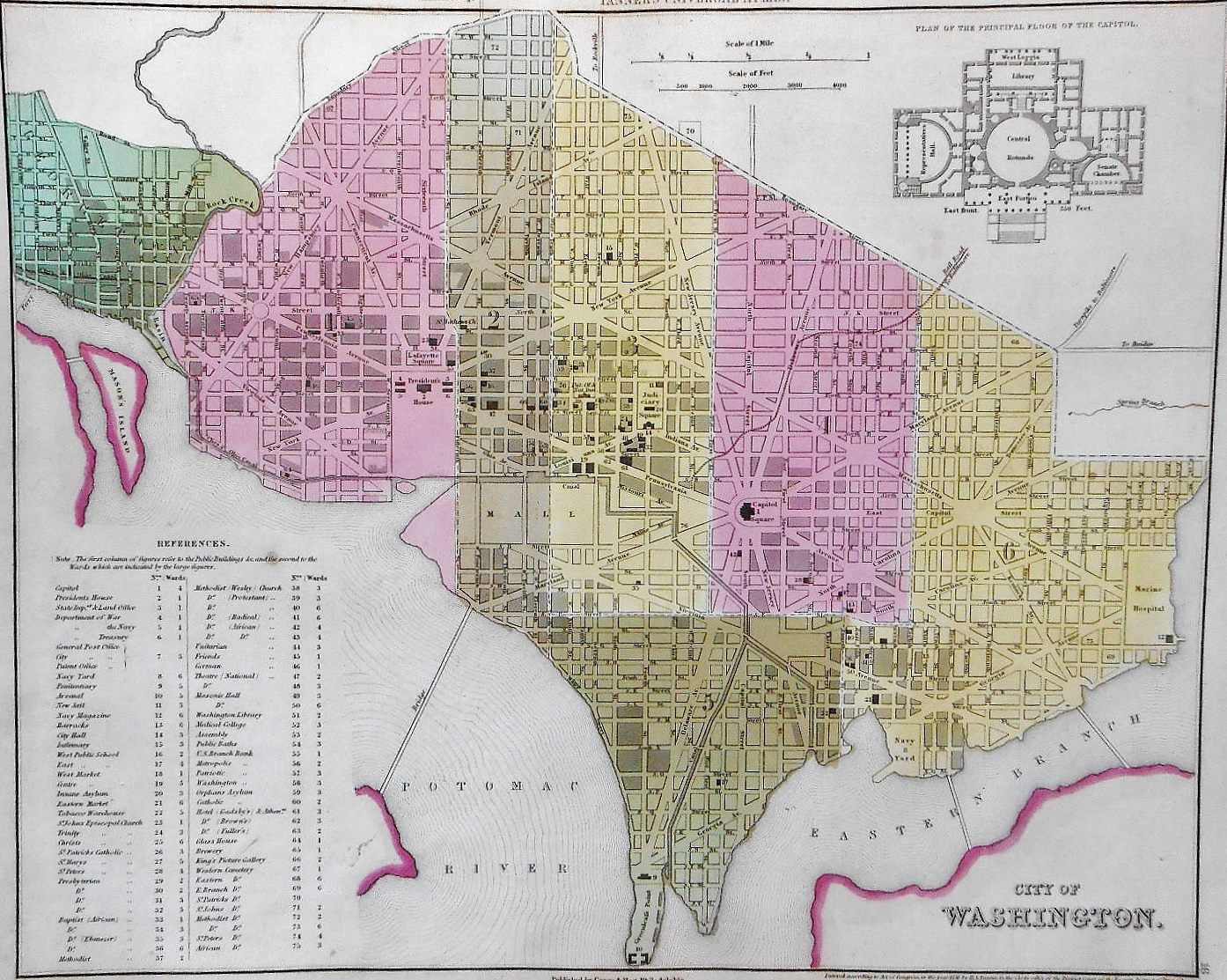
Maps of U.S. States are a valuable testimony to the progressive creation of the United States of America, civilizing conquest of the wilderness and their indigenous peoples in the shade and in the name of the cross, as shown on the title at the landing of Christopher Columbus. They present an additional map of the main cities of the time (Boston, Charleston, Nashville, New Haven, Cincinnati, New Orleans, Baltimore, New-York, Philadelphia and Washington (with the plan of the Capitol), these last three on full pages ; some states are shown with their channels, roads, distances, etc. (as New-York, Pennsylvania, Virginia), North Carolina with the plan of the ” Gold Region “; finally, Wisconsin and Iowa with Indian lands(Sioux, Sauks, Iowas etc.). Note that Texas is represented as an independent republic, and not yet as a State of the Union.
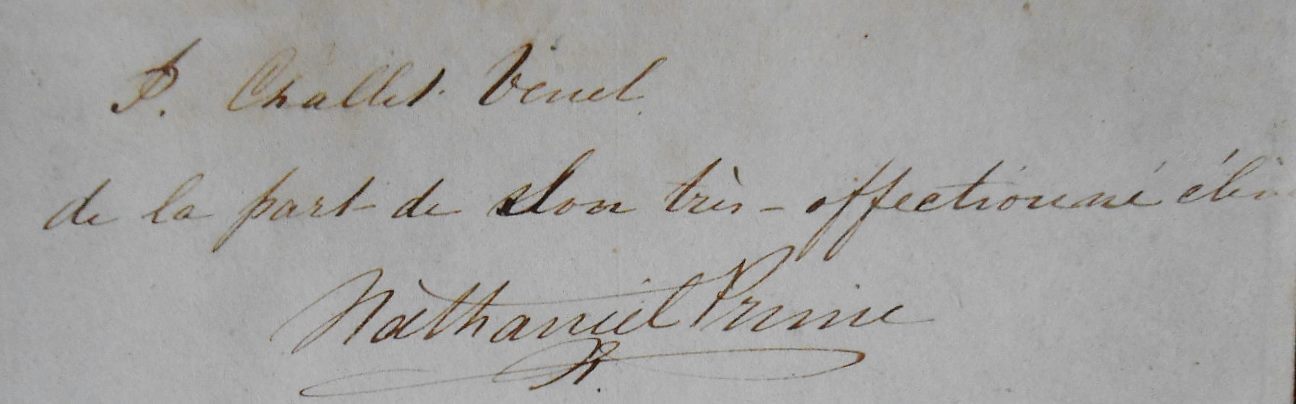
With dedication to the ” P[rofessor] Challet Vénel de la part de son très affectionné élève Nathaniel Prime “. Jean-Jacques Challet-Venel (1811-1893), Swiss politician, member of the Radical Democratic Party was a citizen of Geneva and a member of the Swiss federal Coucil from 1864 to 1872.
French teacher at Venel boarding school in Champel (Geneva Commune), he became its director after his marriage in 1839 with the daughter of the founder of the establishment, geographer and cartographer Jean-François Venel (1780-1855). Co-founder and first president of the National Circle (1851) hostile to James Fazy, Challet-Vénel joins the Geneva Grand Council in 1854. Having joined Fazy’s radical party, he was elected to the National Council 1857. The following year he joined the Council of State (Military Department, then Finances). In 1864, he became Geneva’s first federal councillor, elected after six rounds of voting, replacing ticino Giovan Battista Pioda, appointed minister in Florence. From 1864 to 1867 and in 1869, he heads the Federal Finance Department. His rigorous and far-sighted management has earned it great success, including a loan of twelve million made on very advantageous terms., although he has always refused, as a finicky federalist, to encroach on the tax revenues of the cantons. As head of the Postal Department (in 1868, then in 1871-1872), he was at the origin of the creation of the Universal Postal Union (1874). His non-re-election in December 1872, for the benefit of the Neuchâtel National Councillor Eugene Borel, is due in large part to his opposition to the proposed total revision of the Federal Constitution deemed too centralist. Returned to his canton, he is active in the business community and chairs the Geneva Chamber of Commerce 1885 to his death.

The Venel boarding school was famous; he counted as a student in 1834, Napoléon Camerata, grandson of Elisa Bonaparte, sister of Napoleon Ist, and , the following year, Prince Louis-Napoleon, Jerome’s son, King of Westphalia, future Napoleon III; Nathaniel Prime probably also studied at this institution, and addressed his country’s famous atlas to the son-in-law of the renowned geographer and cartographer. This may be Nathaniel Prime, U.S. Navy captain commanding the 17th U.S. infantry contingent, who received the surrender of the famous Confederate naval lieutenant Charles Read, nicknamed “the wolf of the seas of the Confederacy.”
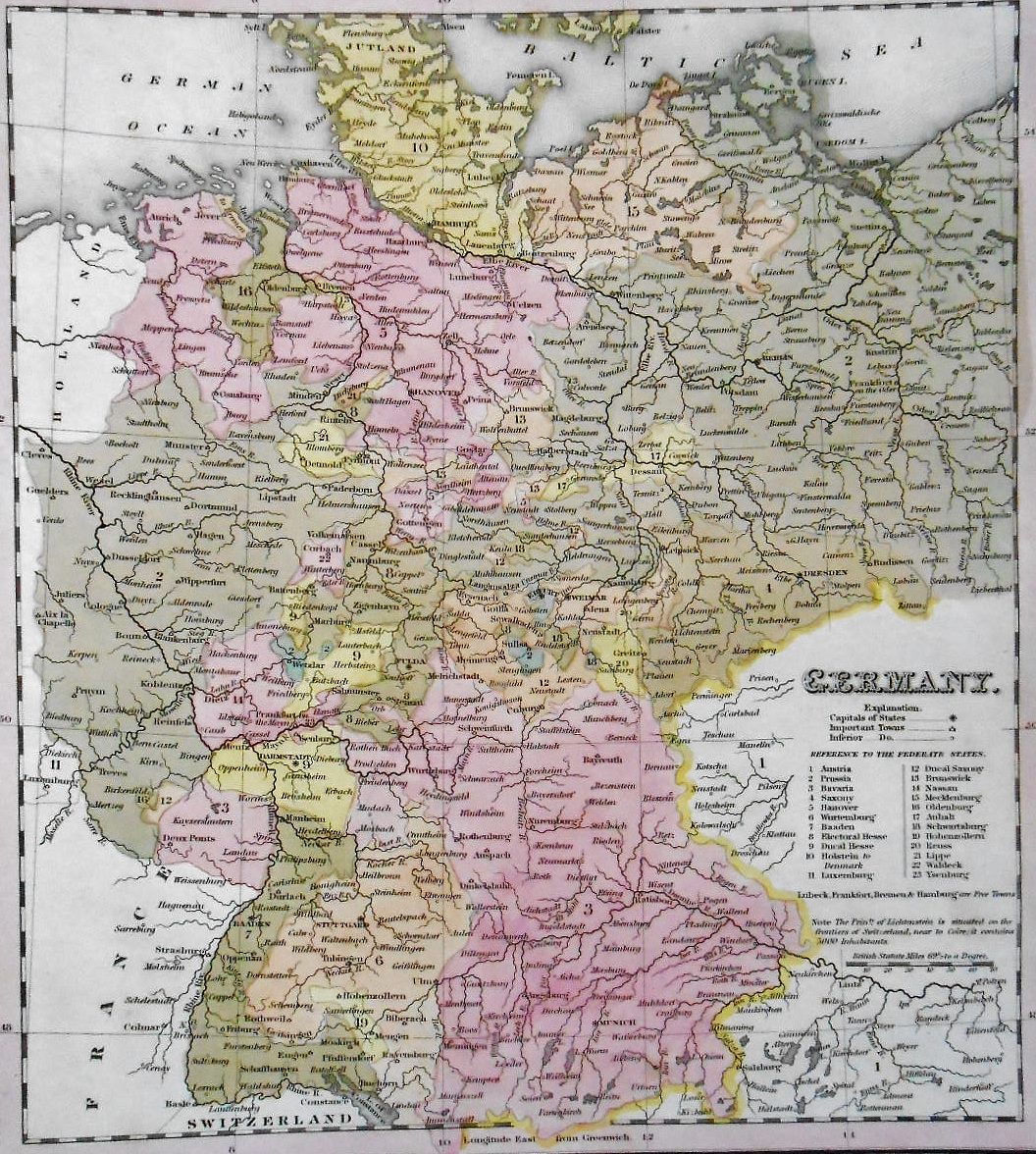
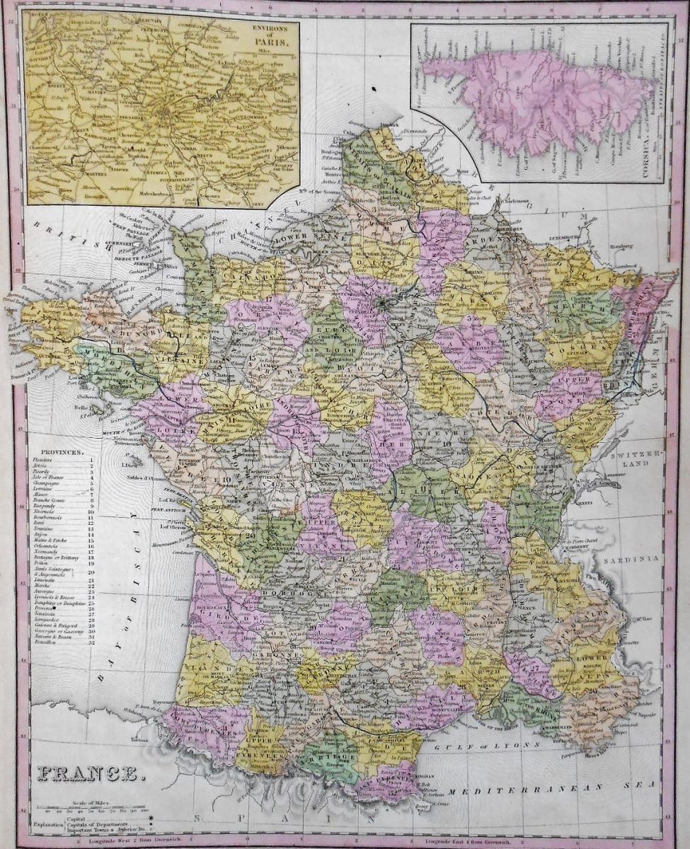
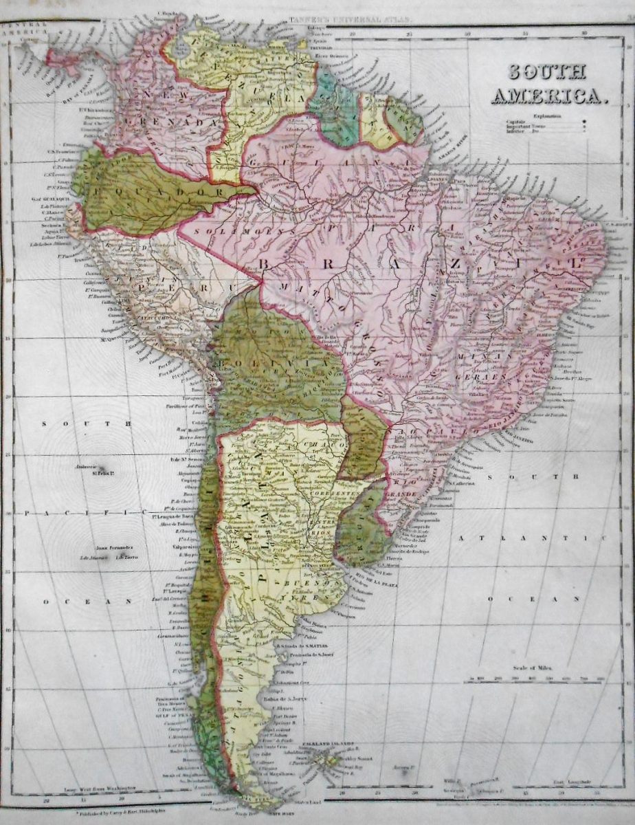
A diagram was drawn in grey pencil on the back of the map of South America (38), some plots have been discreetly highlighted on the map of France (47), some illegible words were written in pencil at the bottom of the map of Germany (50) and the Eiffel Tower was facetiously drawn in pencil on the map of the highest mountains in the world, between the pyramids and Mount St. Helena drawn with the small house of Longwood, last home of Napoleon Ist!
Waterstain on whiteleaves, restored tear on title, few foxing and marginal soiling without gravity, some very rare ink stains out of the maps. Beautiful and rare atlas.

Sold