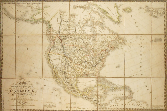
Adrien-Hubert Brué. Atlas. Paris, J. Goujon, 1826 [France, Suisse et Italie septentrionale], and J. Goujon & J. Andriveau, 1827 [Mappemonde, Asie, Amérique méridionale and Amérique septentrionale, Afrique, Océanie and Europe]. 8 watercolour enhanced maps, (65 x 96 cm), cloth-backed, with tab and title on publisher’s label on verso. Contemporary long-grained green half morocco wrappers, smooth spine richly decorated with large gilt roulettes and fillets, two gilt irons extended on either side by two spheres and an iron with an olive branch and a caduceus at the ends, gilt title, gilt lace framing on apple green paper boards imitating long-grained morocco, pink interior.

Large-format maps by Brué revised and enlarged by the publisher according to new material, including the new American Atlas, originally published in 1820, 21 and 22 by J. Goujon.


Adrien-Hubert Brué (1786-1832), is a French cartographer. “Scientific Europe had proclaimed him one of the most distinguished cartographers of the present era. He was a member of the Central Committee of the Paris Geography Society, and associate Member of the London geographical company. […] M. Brué had sailed a lot, he was part of Captain Baudin’s expedition ; he had visited the northern seas as well as the areas around West Africa, and reported from his travels a true passion for science that was to illustrate his life. On arrival in Paris, he began by applying this ingenious process of drawing on copper itself to the making of maps. [encyprotypes maps], which ensures more accuracy and gives the contours more finesse, sharpness, properly modify the orographic system or the land topography, to mark the various rivers with a full line and thus establish, at first glance, their volume ratio. The first maps of Mr. Brué, the five parts of the world traced according to this method announce a conscientious geographer. Oceania was superior to the others by the happy use of the materials then gathered. ” (Larenaudière. Nouvelles annales des Voyages et des sciences géographiques, third volume of the year 1832, pp. 160-161).
All the maps, except the Mappemonde, bear the publisher’s dry stamp “J. Goujon, Géographe, 6 rue du Bac, n°6”.
Despite some rubbing to the boards of the slipcase, the set is extremely attractive, and the maps, in virtually the same edition (1827), are, apart from a few very rare foxing spots and a pale discharge on the Mappemonde, in excellent condition, which is extremely rare.
Sold